by Nick | Jun 30, 2019 | Blog
Spain May 2019
Panic on the M23, it was shut, Gatwick terminals are panic at the best of times. The plane left on time for my cycling adventure / Spanish sojourn. Pink Prosecco fueled the flight, the stuff of 3rd division footballers wives. Premier league would drink Crystal.
Twenty minutes early but an hour later and no sign of a taxi, certainly not the one I’d booked. I discarded the bike box and managed to load the frame, saddle, two wheels, panniers etc. into the back of an estate car. The driver bit his nails while looking over his shoulder, which wasn’t exactly soothing around midnight. I was even more nervous when he communicated that my hostel was in the middle of Bilbao’s old town, a pedestrian zone. As it turned out only few hundred meters from where he dropped me but it could have been the other side of the moon as I staggered with the above constituents of a bicycle, to my room for the night. Half an hour later I was installed in a shoebox listening to Desert Island disks drinking whisky and restoring sanity.
The Mozart Bar in Miranda de Ebro was busy. Wine was randomly splashed in the direction of customer’s glasses. A flux of townsfolk surged and ebbed as they stopped off on route for lunch. A table of local ladies drinking Cinzano were set for the afternoon.
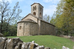
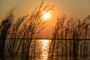
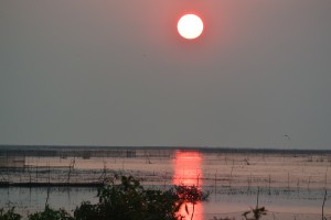
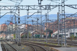 Miranda de Ebro Station
I munched my tapas then went to catch the train pretty much where I came from except a little further North. San Sebastián is only 70km along the coast from Bilbao but no train line has managed to bore through the mountains direct so we came inland then headed back again.
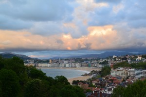
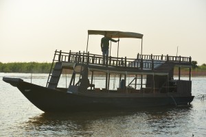
San Sebastian
At the far end of San Sebastián or most distant from the railway station was my hosts apartment block. An ugly building but once you were inside that became irrelevant as you looked back over the bay from my verandah. Nice hosts recommended a bar adjoining a concrete square. Delicious food, I went the next night as well.
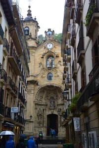
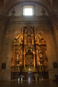
San Sebastian Bay from my apartment block (below). The facade and interior (next page) of The Church of Saint Mary in the old town
Sodden Sebastián and no strangers at the bar, The Church of Saint Mary and the start of the Santiago de Compostella Pilgrimage from the woods behind the apartment block.
From verdant mountains sheathed in mist and showered with rain to the Atlantic foaming gently on the sandy beach for the benefit of the San Sebastianites. I made my way to the old town and the Church of Saint Mary. A stunning façade and vaulted interior led to crypts with gory religious memorabilia.
As the clouds parted I climbed the hillside behind the apartment block to the start of the pilgrimage trail.
I left my gentle hosts the next day to the the barks of their soppy dog waking up the household at 6am and cycled through the sleepy town. A few people going to work and kids emerging out of nightclubs at daybreak.
No bike the conductress told me. Ok I take the wheels off. It had worked from Bilbao, not so easy here. She eyed me suspiciously and wagged her finger when the saddle still stuck out of the luggage rack. Ok I take the seat off and invited her back to check, grudging acceptance until the process was repeated with a more officious conductress. The train effortlessly pulled out of the station and I and my bike were still on board.
We slowly snaked our way through valleys and under hills cloaked by beech and oak. The first couple of hours were so slow that I was wondering if we’d make it to the other side of Spain and Barcelona. The hills gave way to dusty plains and wind blown balls of scrub rolling across the semi desert like the setting for a spaghetti western. A few scratched fields waited patiently for rain, towns in the middle of nowhere.
Storks peered out of their untidy nests built on chimney tops and pillars beside the railway tracks. We reached Zaragoza, the center of nowhere then the train sped up.
The café bar on the Alvina cross country RENFE semi-high speed train was alive and had the same effect on my sleep deprived self. A beer, a dried ham sandwich and happily back in my seat I watched Spain roll by. Barcelona was just round the corner.
Barcelona
‘You’re very lucky,’ said the German proprietor of the third floor hostel, set in an elegant town house. And I suppose I was with a big spacious room lit by shuttered windows opening onto a balcony ledge above the street below. And as a special favor, since I was so lucky, I could keep my bike in the room. My phenomenal good luck was a little overwhelming.
Like a demon possessed I set upon Barcelona to find a bike box – unsuccessful, the Reich kinder boy dismissed my request as absurd. I found another bike shop – warm, call on Monday. A gym, the gym that I went to when I was staying with Tom in what I reminisced to be a remarkably nice apartment. The bars and restaurants we went to around Avenue Parallel. I’m probably going to have to wrap the Trek – my bike, in a Sargasso Sea swirl of plastic to get it on the plane – Plan B.
Showered and clean I headed back to Av Parallel from my incredibly lucky hostel but didn’t make it and had dinner at a formulaic Spanish restaurant on the main road. It was still good.
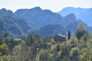
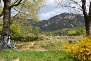
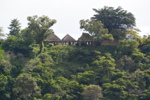
Borreda
Bilbao, San Sebastián and Barcelona connected by RENFE great but my stressed itinerary induced paranoia and in turn blotched skin. The distance flies with the gradient but against one kilometer is worth three and this afternoon’s cycle traversed a thousand meters from the station at Ripoll to Borredà Village. A biting wind blew head on as I turned right and North to the mountains and their snow capped peaks.
Species extinction was headline news as we rush headfirst into environmental Armageddon but not here – yet. Within minutes of leaving the main Ripoll road I heard a cuckoo, now absent from Sussex and as the forest closed in and the countryside descended so the stress departed.
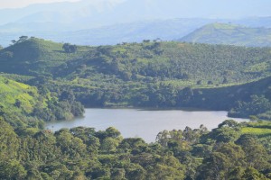
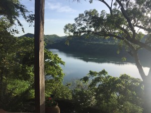
 View up the valley from Borreda (It’s pretty countryside)
A sigh of relief when I got here, that is El Querol Vell a fourteenth century farmhouse in Borredà where I’m staying for the next five days.
The towns seem closed for a lot of the time, their inhabitants guts tuned two hours later than mine. So I’m having tea now I’ve got some when I want dinner, which is at 8.30 or what feels like a midnight feast. Breakfast is 12 hours later at 8.30am and that took some negotiating. Signor El Querol of the same name except as I later found out it was Ignacio, and I became buddies excepting a slight misunderstanding over temperatures. I suggested it was a little above freezing as recorded and shown on the internet, that’s the next valley, the one not supporting Catalan independence I expect.
There’s a box circuit from Borredà to Berga then La Pobla de Lillet where Tom, David and I came off the Haute Pyranees at 1800 meters last year. I remembered the two self-congratulatory beers that were the killer as we had to climb back up again over the fifteen hundred meter pass to get to Sant Jaume de Frontanya and on to Borreda.
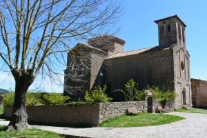
This time I stopped to pay respects to the 11th century church that lit up when I stuck a Euro in the slot. Despite this it was a spiritual place; the thousand year old chapel surrounded by a little hamlet and a friendly dog.
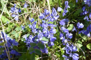
Gentian on the roadside & Sant Jaume de Frontanya
Berga wasn’t in the slightest bit spiritual my first stop on the box circuit but I found some tea. On route was the Embarasment of Balls ok a clumsy slapstick for ?? (Read on) that I rode across to get to Berga. Past Berga I was on B-roads, which allowed for a little wobble when I was looking at the new growth bursting out of the trees.
One place seems to stay open in Catalonia and that’s the bar by the church in the center of the village (Borredà). Anywhere else that one might purloin a service from has only a brief window in their daily calendar allowing the customer the privilege of purchase.
The central bar has a supermarket though the lights have to be turned on from behind the bar and a hardware store but I made do with a couple of Estralla’s, the Spanish beer. Still it wasn’t time for dinner so I watched CNN debating facial recognition in China AKA Huwaei.
Exerting exercise or exercise exertions. Not much sweat in this dry chill environment so soothed and calm if a little extended, restored by being here but eventually dinner is served. What can I do when I’m exhausted? Read a book. I am but it’s disturbing and provocative. Adam should be the dream companion; hunky, beautiful, programmed for sex, biddable but is he? A robot, but when the main character try’s to turn him off Adam breaks his wrist. Way more complex with many issues examined but central to the story is what do we want and when we get it what are the consequences.
I walked through mixed pine-woods along the GR4 long distance footpath, which continues to the French side of the Pyranees. The countryside rang with the sound of birds. Species long declined in the UK. Apart from the sound of cuckoos and the crested tit I saw yesterday, a treecreeper and an eagle, its brown plumage was a disguise, like a cloak over its shoulder.
An 11th century chapel, Saint Sadurni de Rotges. In the middle of nowhere like Saint Jaume yesterday but also still used.
Terraces where once there was agriculture, now glades of trees. Wire fences hung with signs warning Reserva de Caca’s, no hunting I understood. My hackles rose but it gives this mainly or recently unspoilt landscape a purpose and belongs to someone, so it has a chance of preservation. Huge cement works on the way to Guadiole with a fantasy castle for the owner, like the Brecon Beacons in Wales now depopulated and reverting back to nature. And everywhere the yellow flags for Catalan independence.
True to form Vilada was shut. Visions of a non-sandwich lunch faded as the village came to an end with no apparent restaurant but there was a bar. And a little supermarket so lunch was grapes, chocolate and beer more than made up for by the view over the town from the top of the hill.
 Saint Sadurni de Rotges
Walk tall like a lobster. Some bizarre story David, my brother had told me from a self-help book no doubt designed to make him rich. Lobsters don’t walk they sort of scuttle, not helped by having disproportionately large claws get in the way. I think it meant stand up straight so I shrugged the fatigue from my shoulders and strode into town.
Trains, buses, roads, electricity though we had a power cut, sportive zona industriel all thrown at the Catalans as a sop but it sort of makes it worse. Judging from very brief and ill informed observations that maybe this is not the most broad minded or educated region. It feels like everyone’s each other’s cousin when you walk in a bar.
There’s a village not far from Berga called Baga so when you see a sign pointing towards Baga Berga you wonder if anyone has a sense of humor.
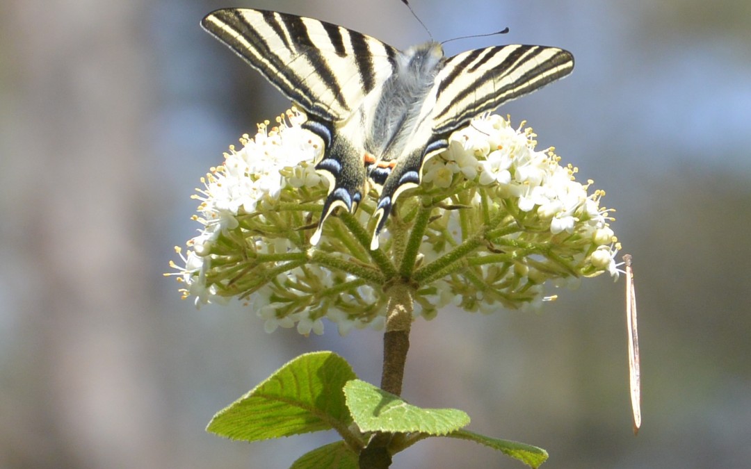
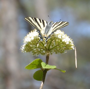 A Swallowtail butterfly
I was getting close, the man in the bike shop in Berga found a bike bag – on his computer, that’s what you want, he stated proudly, Yes I said ruefully. I called the Aryan nation AKA Barcelona bike shop, who said they had a consignment of bikes being delivered so would have a bike box, when?
A piece of piss, I thought bathed in the arrogance of my recently returned cycling fitness as I spun my way basically down hill to the Emballisment de Baels (see before). There’s a little bit of hill into Berga but then it’s a big road beside the reservoir to where I was going to turn off on D roads to La Nou.
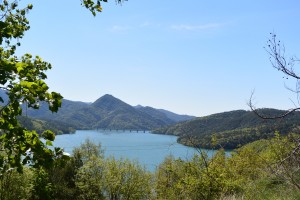 Emballisment de Baels
The road up to the Village of La Nou was steep, not for very long but on a par with the pass to St Juan so I admired the old guy (older than me!) with calves like wire hausers powering up the hill. His face was grimaced in what appeared to be agony so I couldn’t imagine he was enjoying himself but then maybe I look like that.
Of course today when I bought my picnic in Berga to have in the mountains of Nou (La Nou de Bergueda) each bar I went into on route, two in fact, appeared to offer delicious things for lunch and my picnic was anything but; a mango rotten in the middle, a bottle of vinaigrette purporting to be rose, flannel bread and a tasteless tomato. There was some quite nice cheese.
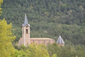 The Church at La Nou
I had my compromised lunch with a massively muscled bull, whispering sweet nothings in the ears of his bell clad cows in an alpine meadow. I know she’s pretty but your clang is more alluring he snorted at another bovine beauty.
 In the mountains of Nou with my Trek
Grhcargh very fast, that’s how Catalan sounds when the boys in the big boots talk in the bar, which filled a little of the yawning gap of time between what was reasonable for exercise and finally dinner. In between Estrella’s I thought about the silver ring that I wear. It’s silver because I’ve got a silver relationship, beautiful but not as good as gold. I was thinking about bringing Manus here – as in Spain. We’d have to sort out food, rice especially but the countryside and El Querol, Laor Na! (Very good in Khmer).
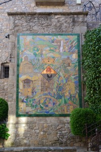 Borreda and its history on a mural in the centre of the village
Talking of which, or not, Ignacio formerly known as El Querol is triggering my nascent French, not that there’s much nascent-cy but its better than a complete absence of Spanish.
A one hundred kilometer circuit South of Borredà and Berga. I came here to enjoy not endure I told myself but looked wistfully at the map and wondered how hard it actually was, so set off the next day.
The twenty four kilometers of small D road between Borreda and where it emerged onto the C road, was one of the prettiest routes I’ve ever cycled running beside the Riera de Merles. Wasted as it was nearly all downhill, so over in an hour. I could have stopped.
You could see a gradation of rainfall in the thickness and height of the forest from where I started to where I turned West onto the main road. It was a hard slog broken when I headed up to the little village of Orvan. The best cold coffee I’d had, it was supposed to be hot. A steep hill before the Berga Valley, a deer leaped in the fields beside the road.
Ignacio was telling me about the depopulation of the Pyranees and you can see it in the now forested terraces and abandoned cement works. Great for tourists or so you’d think except that Spanish tourists apparently care more about cost. It’s not cheap to offer a service in an area where there aren’t many, so maybe the caca is a blessing.
I stopped at a bar and watched a pair of Collared Doves, who while very pretty were not very good at building a nest. The male’s job was finished when he put a twig on the females back. She looked at him as if to say, what did you do that for and the twig fell on the ground. He flew down picked it up and took it back to her. Ok you want me to put it in our nest and she made an effort to incorporate it into the untidy pile of twigs she’d assembled. The egg when it does come is going to give the bar’s customers below an unexpected omelet.
I had a proper lunch in Berga. Paella to start, skate with ratatouille and a tart half way between crème caramel and cheesecake with a bottle of wine and coffee for eleven Euros. Meanwhile I wistfully noticed that Catalans have a healthy disregard for the bodywork of their vehicles, most were scraped or dented.
 La Pobla
Enterprise obviously hadn’t made it to this part of Spain yet, I thought as I checked in for my hired car at Gatwick a few days later. This is a different lifestyle and makes Berga for all of its ennui a worthy place. I pushed my bike along small alleyways around the old church and up to the hospital to where I’d been yesterday to avoid the Tunnel de Berga.
Back in Borreda the boys in the bar were gobbling like turkeys as they talked in Catalan when I went for a last beer.
Cuckoos trumpeted my departure, a concerto scored for all participating songbirds. I remembered the route as downhill all the way. I try hard to maintain a healthy pessimism in my approach to life but my mind gave me away. The first four kilometers were straight up and it wasn’t until the last ten that the gradient shifted. The bursting woods, birdsong, roadside flowers and hills gave this last ride an edge of sadness as I was leaving this beautiful place, Ignacio, El Querol, Borreda. After five days I needed someone to have dinner with but I’d found peace there.
by Nick | Jun 6, 2019 | Angkor, Bike, Blog, Culture, Hike
HYDROLOGY MADE SEXY
Introduction
Angkor is an amazing place. You cannot fail to be impressed even stunned by the grandeur, detail and scale of the monuments. The true wonder of the Angkorian Empire and what it had achieved only started to dawn on me in the last few years. It was when the findings of the Lidar survey were published that I grasped the extent of what was one of the world’s greatest civilisations.
Lidar in layman terms emits an electromagnetic pulse – a laser that is strapped to a helicopter and fired as it passes over the ground to be surveyed. The reflected light is fed through software that strips away the vegetation to reveal the topography and previously unidentified structures.
The results are phenomenal! Phnom Kulen had a city on top. Angkor Thom was laid out in a grid of roads and canals framing wooden houses and their trapaeng or pools. There were thousands of temples not hundreds, and it was all made possible by the management of water in a climate where at the best of times 6 months of rain is followed by 6 months of drought.
I also began to realise that many of our cycle routes, hiking trails and even kayaking adventures followed these ancient waterways. I’d heard Roland Fletcher give fascinating talks at the Amansara Resort and on the banks of the West Baray. It wasn’t until Damian Evans (also from Sydney University) spoke to the guides I was managing that I knew he could tell us what we needed to understand Angkor.
The Water Connection
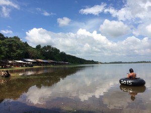
Boeung Ta Neue – our Secret Lake where we kayak, was an Angkorian reservoir formed by an extension of the North Wall of the East Baray, a much larger reservoir connected with the Angkorian cities of Ta Prohm and Angkor Thom. Boeung Ta Neue caught the rain run off from the
Kulen Hills to the North, which fed the Baray and in turn the conurbations of Angkor.
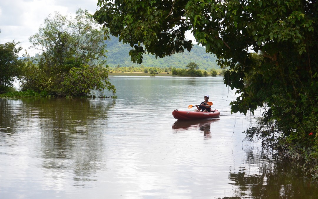
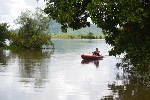 Kayaking on Boeung Ta Neue Angkorian Reservoir (Secret Lake)
Nearby where the Baray finishes and the wall extension starts, is the 7 arched Spean Tor Bridge. Clearly visible by kayak from the water, we managed to reach it through the bush from the red earth road where Damian* had parked.
*Damian Evans archeologist working for Sydney University
We searched on the Baray side of the road for an exit but with none to be seen we couldn’t work out the purpose of the bridge though to be sure a thousand years ago it had one.
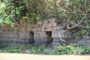 Spean Toh Bridge (named after the nearby temple Prasat Toh
The main water flow into and out of the East Baray was through Kral Romeas, a sluice built into the banks of the East Wall. Cycling and hiking through Phum Samre, the village that lines the walls I’d noticed large laterite blocks and dismissed them as scattered from some Angkorian ruin, which they were. Closer inspection revealed 1 large thick wall and 30 metres away another running parallel forming two sides of the sluice. The raised ground in front of us was a laterite weir. Kral Romeas depending on time of year and water level, acted as an inlet and outlet to the East Baray and may have been connected by another laterite wall running parallel with the East Bank, to Boeung Ta Neue via Spean Toh.
An outlet has also been discovered opposite in the West Bank of the Baray, which fed into the Ta Prohm moat and then onto Angkor Thom. The East Baray at 14 square kilometers, 7km long and 2km wide would have supplied water to the two cities of Ta Prohm, Angkor Thom as well as the houses in between. It would also have been used for irrigation.
Damian explained the scale by comparing the East with the West Baray of similar size containing 50 million litre3 in the West Baray which provided irrigation for 5000 ha of rice, perhaps 10,000 tonnes for each crop. Feeding a population of hundreds of thousands of priests, the aristocracy and merchants who lived in and around these temple cities.
 The West Baray at the end of the rainy season
It was also unlikely that the 3 great water reservoirs of the West, East and North Barays were in simultaneous use but acted as a stabilising backup during times of drought and flood.
The scale of these man made hydraulics are unparalleled in human history and truly mind-boggling. The 3 spatial dimensions have to be combined with a 4th chronological dimension as the kings and climate changed over time. History seems to have been determined as much by the weather as the peaks in the empire. First during the reign of Suryavarman II in the 12th century then under Jayavarman VII in the 13th century, which coincided with the peaks in rainfall we saw from the ancient records on Damian’s computer screen and heralded the construction of the great temples of Angkor.
It is now suggested that the ultimate decline of Angkor was linked to periods of extreme drought followed by floods, which washed away the channels needed to supply water during the dry season. This is most clearly seen at Spean Thmor between Ta Keo and Angkor Thom where the old bridge lies high up the banks of the river now running meters below.
An as yet unexplained mystery is the adjacent 10 x 10 grid of a 100 mounds a few hundred meters from Prasat Toh. Similar grids have been found beside the ‘River of a Thousand Linga’s’ at Kbal Spean and Sambor Prei Kup near Kampong Thom, both associated with major water systems. No artifacts or remains have been found at either site that give any clues as to what the mounds are.
Walking through the site with Damian we spotted fragments of curved roof tiles in a papaya plantation that in an act of unintended vandalism, has been planted right over the mounds.
Most of what is known about Prasat Toh comes from a 4 sided stele (a stone pillar with carved enscriptions) discovered by the French in the 1930’s and now stored in The Angkor Centre for Conservation in Siem Reap. The Sanskrit engravings were translated and available on line. They explained that the stele had been installed by a Brahmin priest during the 13th century and referred to the Great King Jayavarman VII. The inscription mentions the Ganges River in association with water, which may have had something to do with the Kral Romeas sluice and was the same as an inscription found at Phnom Dai temple to the North, the site of another grid of mounds. The temple itself appears to predate the stele and is maybe contemporary with the 10th century East Baray.
 Prasat Toh and its 3 laterite towers situated near the North West corner of the East Baray
Randomly cast on the ground were the now eroded but once richly carved sandstone blocks that had adorned the structure including the stone crown that sat atop the central tower. Interestingly it had a hole in the middle, where a bronze finial in the form of a trident could have been positioned. Possibly removed at certain auspicious times of the year to bathe the Goddess Shiva sitting 15 meters below in sunlight.
Set amongst brilliant green paddy fields on the other side of Beoung Ta Neue is Leak Neang or Hidden Lady Temple. Dated to the 10th century and built at the same time as the spectacular brick temple of Preah Rup. A stele, which may give some clues to its origins has transferred to the Angkor Conservation for translation.
 Leak Neang with its single brick tower
The bricks used in the construction of the structure are themselves a mystery as no kiln has ever been found. A theory speculates that the bricks were fired in a dedicated kiln close to the temples made of bricks, which were also used. The apparent black scorching seen on the walls seemed to support this idea.
Not only was this masterly management of water used to supply The Angkorians and irrigate their crops, it also conveyed the enormous amount of stone required to build the temples. Laterite is an iron rich clay that is soft and easy to dress into blocks when it comes out of the ground. On exposure to the sun it becomes very hard but relatively light making it ideal for the foundations but not the decoration as its pock-marked surface is not easily carved. The laterite quarries lay in the hills to the North West. Dams collected water from streams which was released into the Great North Channel that carried the stone blocks South to the North Baray from where they were used in the construction of Angkor.
At the Eastern end of the Kulen escarpment were quarries that supplied the sandstone, which was carved into the marvelous facades of the temples. As part of this network another channel ran from Beng Melea near the Eastern Kulen escarpment, past the Temples of Banteay Ampil and Chau Srey Vibol to Prasat Batchum inside Angkor Park. A path still connects these sites and makes for a great cycle ride.
We were beginning to get a handle on the Eastern end of the water connection, now it was time to explore the West. The Siem Reap River flows South from the Kulen Hills to the city and then onto the Tonle Sap Great Lake but during Angkor it was diverted into the North East corner of the Angkor Thom Moat. History is being repeated as subsequent to the floods of 2011 the channels have been reopened and another dug in parallel on the North side of the moat as the river is diverted into the West Baray with the aim of stopping the floods in Siem Reap. The fact that now the town of Puok to the West floods instead is not part of the discussion – tourists don’t go there.
Angkor Thom the largest of all the Angkorian Cities, was the capitol under Jayavarman VII. its wall’s 3km long enclose 900 hectares or 9 km2. Now forested but once the site of a thriving metropolis of wooden houses and trapeang (pools), surrounded by a grid of canals and roads as the Lidar survey revealed.
 View over the moat from the walls at the S.E corner of Angkor Thom
The data was detailed enough to show the individual houses, which can be extrapolated to give a guessed population of 70,000 based on an assumed family size. This would need a lot of water but during the rainy season any excess flowed out of Boeung Thom reservoir in the South West of Angkor Thom and through Runta Dev a canal that runs under the walls of the city into the moat. We’ve got a stunning cycle route that runs along the 8m high walls of Angkor Thom to Prasat Chrung or corner temple. A great late afternoon spot for watching the sun set over the moat, paddy fields and palm trees beyond. We didn’t realise the engineering marvel that lay 8 meters below us until Damian lead us down the inner banks to a stream that on closer inspection disappeared into a laterite tunnel under the walls and out to the glinting light of the moat 30m away.
The West Baray 500m to the West is yet another mystery. How was this vast body of water replenished and released during times of flood? The current outlet of the Angkor Thom moat is a canal running parallel with the road through the West Gate dug by the French, which destroyed any trace of what was there before. It is possible it was a replacement otherwise how did 50 million litres of water get into The Baray?
 Runta Dev runs under the walls of Angkor Thom
What had we learnt that morning?
We understood that water running off the Kulen Hills to the North fed streams, which flowed into the reservoir of Beoung Ta Neue in turn feeding the East Baray, which was a water supply for the population of Angkor Thom and Ta Prohm.
Damian confirmed that our cycling path to Chau Srei Vibol and on to Banteay Ampil, lay along the route a canal had taken bringing sandstone from the quarries at the Eastern end of the Kulen escarpment via Beng Melea to Angkor.
He explained how the laterite blocks used to build the foundations of the Jayavarman VII temples were carried by water released into the Great North Canal which flowed from the quarries at the Western End of the Kulen Hills to the North Baray and father temple of Preah Khan.
And the Western hydrological connection was made by the Siem Reap River coming from the Western end of Kulen flowing into the Angkor Thom moat and maybe on into the West Baray.
And much else besides!
With great thanks to Damian Evans for a really fascinating morning and apologies for any misinterpretations.
Indochine Exploration with Smiling Albino Cambodia is pleased to take our guests on a introductory investigation of the main temples along the water courses described or an adventure to experience this incredible landscape on foot, by bicycle or kayaking.

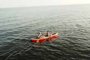
by Nick | Feb 22, 2019 | Blog, Cambodian Journeys, Kayak, Uncategorized
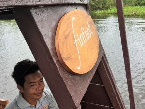
finfoot
1. The finfoot is Hatched
finfoot was born in Prek Toal and conceived in the myriad of marshy waterways that come and go with the flood and ebb of the lake across the floodplain.
 The Tonle Sap Lake during the ebb and Prek Toal Core Bird Reserve (below)
The Masked finfoot is a shy and reclusive water bird skulking in the marshy vegetation lining rivers and lakes. Spotting the bird is a rare and wonderful experience, which seemed a good enough reason to call our boat finfoot (masked is too difficult to pronounce).
 Early morning egrets in the Core Bird Reserve
I came to Cambodia as a volunteer business advisor to a French NGO. The aim was to provide alternative livelihoods for the families we were working with on the lake. One of these livelihoods was ecotourism but they hadn’t got any guides, hence my first encounter as a bird guide with The Tonle Sap Lake and Prek Toal Core Bird Reserve.
 Masked Finfoot Hellopais personatus
I didn’t know anything about either but was overwhelmed by the spectacle of the place.
Years spent in Cambodia passed by but my love affair with the lake remained. The phenomenal change driven by the backflow from the Mekong River was maybe reminiscent of the massive tidal zone around Jersey where I’d spent my childhood holidays. The extent of the lake and its inaccessibility, but not if I had a boat!
We’d got something to go on. The uber luxury resort Amansara had a boat called Amanbala. She was the brainchild of Sally the GM and a friend, so not to be copied while she was here but now she’s long gone, fair game.
We started with a wooden hull that seemed enormous and a rusting tangle of metal passing as an engine. It had towed a wedding platform from Prek Toal to the mouth of the fishing channel that leads to Maichrey when we staged the Bill Bensley Boat Races.
The message from our Thai business partners was full steam ahead, just put a business proposal together. So Buntha and I set off for Prek Toal. Buntha’s brother in law, the BiL, in more prosperous times had been a fish merchant as well as crocodile farmer. Moored behind his house was the hull. Once a container for transporting fish across the lake to Chong Khneas where some of the cargo made it to Thailand or Vietnam, while the rest rotted back to where it came from.
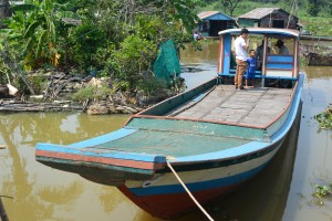 finfoot as it was behind the BiL’s house
The BiL connected a big battery to the engine, turned a key beside the Camry steering wheel and the machine roared to life. We nosed round the Chheang collection of floating houses into the main channel. The boat was steered by ropes connected to a long tailed propeller shaft that slowly shifted it in the desired direction. There was no cover or sound proofing but the powerful sound of the big V6 engine was infinitely preferable to the minding numbing cacophony of the 2 strokes that drove the fiberglass long-tails screaming through the village.
Safely away from where our wake could do no more than shake a floating carpet of vegetation, the BiL pushed forward the throttle and the boat took off! The distant lake rapidly loomed large as we almost planed towards it. Two tons of solid wood doesn’t exactly lend itself to planing. The fuel gauge if we’d had one would have been spinning as litres of diesel exploded in the cylinders.
That was last year – 2017, when the lake reached its zenith. This year – 2018, as the water and our guests receded my focus returned to the boat. I put the requested proposal together for our business partners and waited for the green light but after umpteen revisions the light went orange and finally nothing at all.
The dry season window was evaporating when the boat builder could work all day, and most important the next tourist season looming.
I was back in the UK and weary with the sound of my own enthusiasm coming to nothing so the project stalled. Skip a month to Menorca, a weekend away with Laura an industry friend and her pal Duncan. ‘Tell us about your boat,’ they said so I did. ‘We’ll give you 25% – each.’ Ok so the projects incubating. ‘I will too,’ said my brother and the egg was on its way. Another investor in Siem Reap had agreed to 25% but that was talk so the last share became mine.
‘Buntha what’s happening with the boat?’ Was nearly the first question I asked when I got off the airplane from the UK, ‘nothing Bong,’ ‘well let’s make it happen.’ So we did. Mr fixit AKA Buntha found the boat builder at the tourist port of Chong Khneas, who’d built the Amanbala for Amansara.
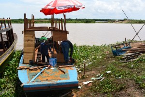
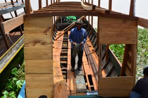
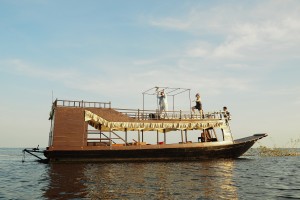
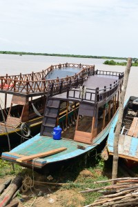 The metamorphosis of finfoot
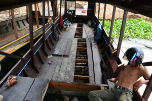
We forced our way through the tourist port, ‘not come here,’ the check point charlie ordered. ‘I’m not a tourist, I’m having a boat built.’ My Khmer didn’t cut any ice, I was white and therefor a tourist. I sat and glowered at him until the boat builder fetched me to see what would become a finfoot. We agreed a price, paid him something to show we were serious and that was actually that. Weekly visits to watch the metamorphosis of the bare wooden bones into finfoot went incredibly smoothly such that within a couple of months she was born.
2. finfoot flies
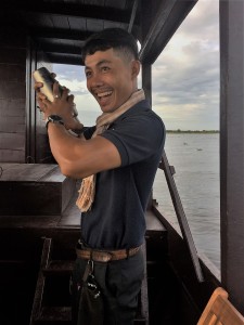
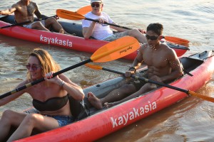
Our Team together with Joni, the GM of Treeline, friend and witness went to Chong Khneas as apparent tourists. Well that’s how Joni & I appeared, the rest are Khmer. We were herded down the gangplank onto the boarding platform and whichever tourist boat and disinterested driver we were to be allocated with. ‘We have a boat,’ I dismissed some tout having spied Heang our captain and finfoot moored and ready, then with a huge surge of pride stepped onboard.
finfoot powered across the floodplain with its big six cylinder lorry engine. Out on the open lake I took the wheel, opened the throttle and felt a surge of oomph. There was still another 30% to go. Our direction towards the forest was slightly disconcerting, I thought as I tried with no effect to correct it. Heang you’d better takeover, I suggested. It steers a little to the right. ‘Yes Bong,’ as if to say that’s why I’m the captain.
 My efforts as Captain and Heang correcting them
We moored at the mouth of the Maichrey channel, opened a bottle or two of Prosecco and took self-congratulatory photos.
The Team felt good and on the way back Lors was trying to engage Joni with the usual Khmer chat up line of why aren’t you married, not known for its subtlety. Grasping that the approach wasn’t going well he changed the subject. ‘How do you spell biopsy Nick?’ Sadly his mum had a breast tumor. Tiger grinning, ‘how do you spell f – – – Nick?’ ‘Not sure Tiger, ask Joni,’ even Lors laughed.
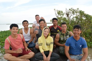 The Team (left to right) Bunthy, Tiger, Me, Buntha, Sreymom, Heang, Lors & Ra
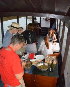
I wanted a space where Dean our partner in cocktails and canapés could work his magic so I commissioned Oyen the cabinetmaker to make a bar with an inset sink behind. Dean had to see it so just before setting off to the UK, Dean & Buntha together with Tiger & I launched our kayaks behind Phnom Kraum and paddled 10km to where the Maichrey Boat Station should be.
Deans bar
It started this year with a dam across the Mekong collapsing in Laos just North of the border with Cambodia. The surge of water that flooded down the river kicked off the backflow up the Tonle Sap River, which in turn flows into the Tonle Sap Lake. Heavy monsoonal rains filled the tributaries adding to the tsunami of water that was swelling the lake near to where it had risen in 2011. We glided across what was and soon will be again the semi-swampy floodplain straight to the boat station except the road was now flooded and the tourist boats were moored in the grounds of the local pagoda, usually a kilometer away. Tiger reappeared with a cold beer, my hero then the van bearing our guests and Dean’s cocktails arrived.
 Naida’s IPhone photograph of the lake as we headed back to the pagoda
Moored behind a semi-submerged tree, we finished Dean’s cocktails as the sun sank through strata of cloud. Then Naida and the boys moved onto neat gin. We’d run out of tonic.
3. The final fit-out
Yes, yes, yes, said the fabric lady, when I explained that we wanted her unsightly but protective plastic curtains rolled up and wrapped in our beige canvas. The result was reminiscent of a 1970’s B&B in Aberystwyth and I should know, I’d lived in one! We’d also commissioned a canopy for the top deck to shade the mattresses she was going to make. The canopy remained elusive and the mattresses bore no relation to the space where they were to fit. She the fabric lady had sent someone to fit it all out but I don’t think they could count and I had to pay for the changes as she’d got our material that we’d sourced from Australia.
Meanwhile Oyen the cabinetmaker had finished everything he said he would by the time he said, though his daybed collapsed when he sat on it (he quickly came back to fix it). A ships wheel not the steering wheel of a Toyota Camry, the usual method of changing direction for most boats on the lake. I’d managed to find one at a ships chandler in Newhaven, Sussex along with the LED lights we needed for our sunset cocktail trips.
October last year I was back in the UK having one of our weekly Skype calls with Buntha. ‘Bong I’ve got good news and bad,’ or words to that effect. ‘Yes?’ ‘Well which?’ ‘Bad news,’ ‘the engines broke,’ ‘go on,’ I said, just in case you’ve lost the thread of this conversation. As soon as the subject gets technical English ceases to be an effective vector for communication. ‘So what’s plan B?’ I asked. One of the great things about Buntha is he has plan B’s. ‘I’m going on holiday.’ He didn’t actually say that but that’s what happened. He and the mechanic first went to Battambang no luck then to Phnom Penh. Bingo they got the required widget, something to do with the gearbox, and returned. Widget cost $250, traveling costs $250, fixed engine priceless and $900 cheaper than the ‘Bong it’s going to cost $1500.
4. Finfoot adventures
Stephanie and Jules from Bangkok together with Manus & I photographed by Serey and spoiled by frilly curtains

 Christian + partner with Tommy on the top deck while Tiger mixes martinis by the bar
 Christmas eve BBQ on board (you can just notice the correct curtains)
Our finfoot adventures had been piling up since that happy day we set off on our maiden voyage. It had been a hard week, the constant stress of our impending Smexit (a legal separation from our business partners) and a whole host of other obstacles real or imagined. We needed an excuse to get out of the office.
Manus uncharacteristically turned up on time so we; Buntha, Ra, Lors, Jin and Tiger with Manus set off to recce a big gay wedding party booked for next month.
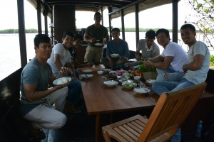 Left to right; Ra, Tiger, Heang, Lors, Jin, Doitch (our van driver), Buntha and Manus
The context was Bill Bensley’s Boat Races in 2013 https://indochineex.com/blog/bill-bensley-boat-races-indochine-exploration
We had towed a wedding platform 15km from Prek Toal to Maichrey. His staff raced traditional water festival racing boats, while our muscle boys, ten of them including Manus, paddled Bill’s inner circle between the racing boats. A photo of Little Tee (left in 2013) and his biceps sold the trip this time so a newly married gay couple will use us to set up a party, with muscle boys on a platform at the edge of the lake.
The issue was the platform we’d used before had sunk when they drove a Caterpillar earthmover on it, so our mission today was to find another one. A job for the Sisters of Mercy and their volleyball court, unfortunately it was holding up the school, which wouldalso sink if we towed it away. Buntha had yet to come up with plan B.
Lors had a chicken smoking on the BBQ, Ra laid the table, Tiger took his shirt off, Jin blended into the background, Buntha sorted out the Sisters of Mercy while I relaxed with Manus and thought about our next adventure, a night on the lake with Manus on finfoot.
‘I want to sleep on the boat,’ Manus told me, and so did I but customers got in the way until the staff lunch.
 Sunset on The Tonle Sap Lake
Upstairs or downstairs was the question. Cool with a view was the answer until I thought about falling off when I need to piss in the middle of the night so we strung up a mosquito net above the downstairs daybed.
Our rival operator as in David and Goliath, where we play the role of David, had kindly constructed and conveniently situated a small platform where the Maichrey Channel meets the Tonle Sap Lake.
 Manus on Goliath’s platform and Heang on the prow of finfoot
Heang moored finfoot alongside and I set off in a kayak to watch the sun sink into the Lake. The fishing season has started so the lakeshore is fringed with a maze of fishing nets designed to catch fish, not kayaks presumably. It was a puzzle how to avoid being funneled towards the trap where the unfortunate fish end their life’s journey.A few weeks ago quiet would have settled on the still waters as the sun sank now the staccato clap of 2 stroke engines reverberated as the fishing boys took watch.
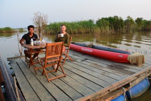
A golden path lead from the West to finfoot and our platform for the night, where Manus had a set up a table and chairs. Heang was cooking. I’d forgotten any oil so he was braising our chicken in Cambodia beer, in the meantime I’d bought a bottle of champagne.
 February sunrise over the Lake
Heang and Manus sat on the platform as dusk descended and I popped the cork on a bottle of Moet. Manus likes champagne and so unfortunately did Heang, which meant there was a little too much sharing and not enough beer afterwards because it had been poured on the chicken!
It was cool so Manus and I curled up together. The precautionary Valium induced a soothing torpor little penetrated by the predawn clatter of fishing boats. Manus sweetly bought me a mug of tea when I woke and we watched the sunrise through the fishing fences from the East.
 Breakfast on the Lake
A couple of coffee’s later we reluctantly headed back. We’d missed the sweet spot when the lake’s high and the fishermen are back in the village mending their nets but it was still a beautiful experience.
Philip and Stefan’s wedding party a couple of weeks later amongst the fishing fences and Mali the muscle boy with one of the guests
by Nick | Jan 11, 2019 | Angkor, Blog
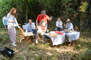
Christmas Lunch in Prasat Pong Keou Temple
In the glory days of our romance with Amansara* we had helicopters and oxcarts to and from the Tamarind Temple in the city of Angkor as a standard trip. Last year Apsara, the temple authority built a road and put an end to our white tablecloth champagne temple lunches. So we needed a new one – temple that is.
*The uber luxury Siem Reap Resort
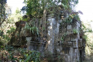
It all started 8 years go when a monk came to see me about a forest and we discovered a temple ………..
Skip 8 years and we were trying to find it again not helped by its many names. Prasat Yoni or Temple of the Vagina being the most mentioned. Our adventure guide was given the mission and came back with a photo and tales of a temple but not the one I remembered.
 Chum Nean the monk, who in 2010 was trying to protect his village from the encroaching rubber plantation and took me to Pong Keou
Yet another year and now motivated by an enquiry for a temple lunch we set off as a team on mountain bikes through the bush. Armed with local knowledge gleaned from villagers on route, we came upon a patch of forest but still no sight of it. Then hacking through the vegetation with machetes the laterite walls appeared.
 Our first sight of Prasat Pong Keou in August 2018
Skip to October at The Ivy Restaurant in Chelsea and a lady called Di who had a client called Peter and we’ve almost got to the start of the story on Christmas Eve. But not so fast, there was a helicopter to organize. It seemed simple in August when we first found the temple but by October when we went to choose a place to land and record the GPS coordinates, the dusty dry countryside had become a large lake. Forget helicopters kayaks would have been more useful, we went back again at the beginning of December to choose the landing site.
Let me introduce the supporting cast for this performance; Ra our temple host, Buntha AKA Mr Fixit, Miss Wong master chef Dean. Then there was Black-dog the van driver and Bong Kroyun, who steered the tractor or kroyun *and Mr Pal who made mince meat of helipad construction. Oh and myself. My main job was to panic and pester to the point where it was easier to get the logistics sorted than put up with me.
*kroyun lit. motorised buffalo cart
Things go at their own pace, to be messed with at your own peril or most likely slowing down whatever you want speeded up. So while I hadn’t a clue why we were waiting at Buntha’s house in Samrong his village on Christmas Eve, it became clear as events took their own course.
Logging, encroaching agriculture and forest fires had taken their toll since we last visited. The paths looked different and we went down the wrong one. Not an auspicious start to our big adventure.
Who was our guest? I can’t really say, client confidentiality and all that but suffice to tell his online profile was considerable and intellectually engaging. The rest of his family; Sarah his wife and 3 fey daughters, Princesses sheathed in gossamer gowns, crowned by coronets – lady’s of the lake.
Mr Pal, Buntha, Black-dog and myself hacked our way through the undergrowth, finally glimpsing the blocks of laterite that made up the walls of the etheral Prasat Pong Keou, as much a myth as reality. As if that wasn’t hard enough termites had colluded to prevent entry. There was a tantalizing peek at the West entrance but short of wriggling across a bed of ants no way in. Illegal logging and vandalism had bulldozed a hole in the wall to get at a valuable rosewood tree, our necessary entry point.
 What used to be the entrance to Prasat Pong Keou
The gash in the wall was like a link in time to a thousand years ago when a different world was inhabited by a culture that hadn’t yet outgrown its environment. A microclimate of intense humidity and heavy mystery hung over the ancient remains of what the kroyun driver told us was a halfway house along a long gone Angkorian road between the major temples of Koh Ker and Beng Melea. Our presence was like a warp in time but not space as we carefully cleared away the secondary growth since whoever had been here last.
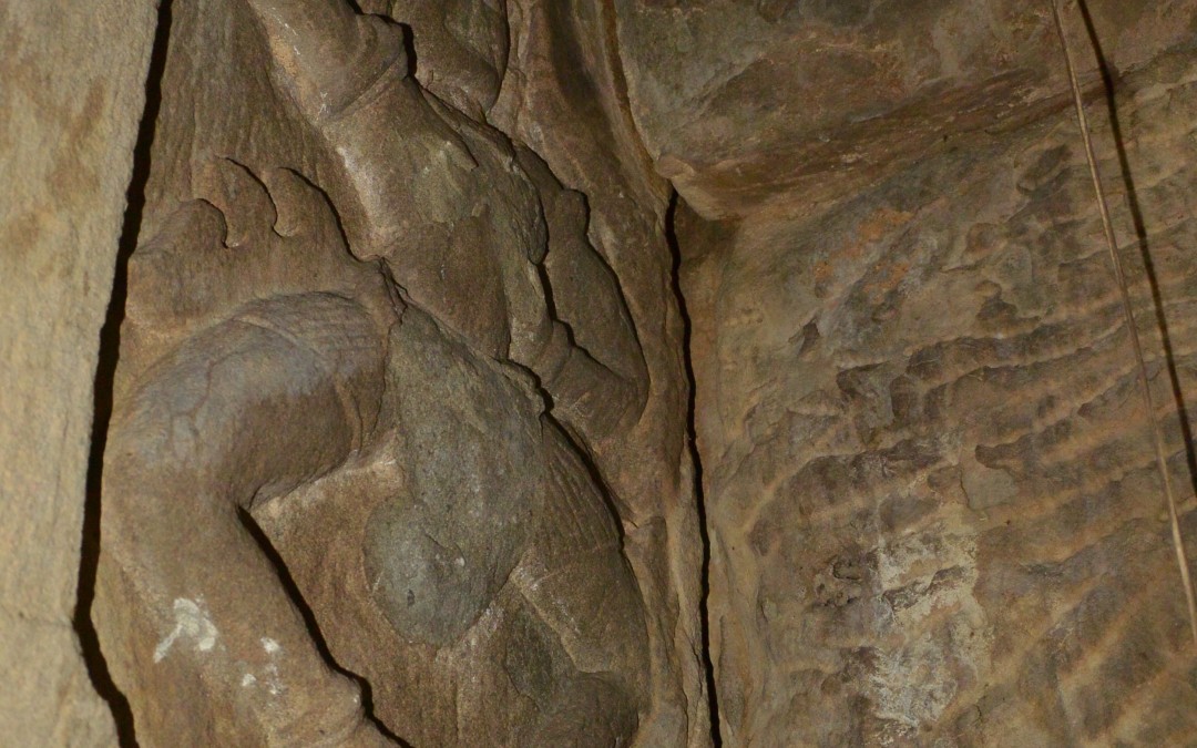
Tripping over tilting stones we found a central tower block with multiple entry points. One lead to a blind chamber adorned by primitive Apsara*. Four had been defaced but the furthermost corner carving had escaped the vandals. Fern fronds hung from the temple terraces like they were planted at a Chelsea Flower Show feature garden.
*Celestial dancers
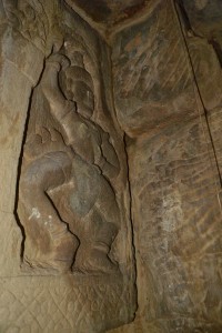
Unique Apsara (left) and the central tower block at Prasat Pong Keou (right)
More to the point where were we going to balance the table and chairs for Christmas lunch? We retreated to clear a route through the vegetation and coarse grass back to the rutted laterite road we’d left. We saved the helipad for the next day. We leap frogged each other as our motorbikes took it in turns to get punctures and made it back to Buntha’s house in Samrong.
A house if you’re lucky enough to have one is just a space in Cambodia. We furnish and decorate our rooms according to what we’re going to use them for in a way that pleases us. In Cambodia if you want to wash you find a space where you can scoop water from a pool. If you want to cook you use a clay charcoal pot to boil or fry whatever you’re cooking. And when you want to sleep you roll out a mattress, hang a mosquito net and if you’re lucky position a fan. In spite of or because of this different approach I lay on my comfortable mattress in relative cool, clean and well fed.
Christmas morning and there was a kroyun* where Buntha had organized one to be and another on its way so we set off to scythe rice straw. I seemed to miss the straw and hit worm mounds sending the blade flying from its handle and quickly turning the callus on the palms of my hands into blisters. I realized that my future career didn’t lie with rice farming.
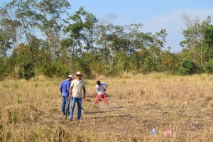 Preparing the helipad; Buntha (left), Mr Pal and Bong (Brother) Kroyun
I was much better at making an H. It started as an H but we cleared some more rice stubble so added an I and connected it to the H with a hyphon = I-H. Since our retiring temple seemed to change location each time we visited I went to check that it was still there and see if I was better at hacking vines than rice straw.
Dean had arrived on the second kroyun, so we ported the provisions through the gap in the walls and proffered the stage from which he was going to work miracles, so far so good. We cycled back to the helipad to see if the helicopter carrying our precious guests had arrived.
Meanwhile the rice farmer whose field we’d appropriated had turned up. He’d heard on the jungle grapevine that a barang* was digging up his land. Pacified by Buntha he saw instead that we’d cut his straw for him so he retreated to a safe distance to watch the fun with his wife.
A while later a whir could be heard across the forest and the speck in the sky materialized into our aircraft. It circled the landing site a couple of times, deciphered my I-H and descended amidst a blitz of rice straw.
*barang lit. Frenchman but used as a general term for all white foreigners
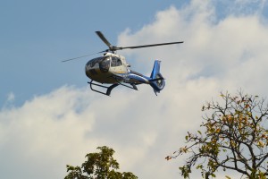
 Our guests approach and land
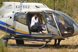
“Mr Fletcher I presume,” I’d been saving it up for a long time. “Good to meet you,” he generously replied. We arranged his family on the kroyun trailer and set off on the trail for lunch.
It had been a good call to mechanically convey these gentle creatures rather than line up mountain bikes and expect them to wade through the sand. A chain of boys was waiting to guide them through the laterite portal to where Dean like a big mother hen dispensed cold towels and bonhomie. “Your temple.” There was a collected wow before they started exploring its nooks and crannies then settled for champagne and turkey.
 Mr Wong performing Christmas culinary magic inside the temple
I sat slightly aside on a stone with a glass of Moet and for the first time in 36 hours started to relax. The Moet gone and half a bottle of Dean’s Prosecco later, I was definitely relaxed as I said goodbye to the guests. Replete with the considerable remnants of the guest lunch, the ‘team’ lined up to convey the cool boxes and general paraphernalia back to the kroyuns.
Buntha and I raced ahead on mountain bikes too elated to notice the clogging sand we glided over. We caught a glimpse of the helicopter circling above the trees and that was the last we saw of our guests for Christmas lunch at Prasat Pong Keoy.
As a footnote the kroyun drivers were well rewarded and anybody to hand back at Ta Siem Village got a can of soda. Everyone involved in the undertaking was generously tipped. ‘Could we do it again Buntha?’ ‘Yes,’ he said confidently, ‘we’d just have to pay more.’
I received several messages that night from Mr Foster – not his real name thanking us for an extraordinary event. Di had asked for something that nobody else had done before. It’s very unlikely that in the temple’s thousand year old history anybody has had Christmas lunch there, especially not a family from London.
by Nick | Jan 1, 2019 | Blog, Kayak
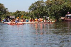
The Bill Bensley Boat Races by Indochine Exploration
‘Nick I’ve got an amazing booking for you,’ said Christian the GM of Shinta Mani. ‘That’s great, what?’ I replied a little apprehensive knowing Christian. ‘Kayak,’ ‘Ok how many?’ ‘120’ ‘We can’t do it.’ ‘Why are you always so negative,’ Christian mocked. ‘We don’t have 120 kayaks. There aren’t 120 kayaks in Cambodia,’ ‘You’ll think of something,’ Christian reassured.
The Racing Platform
Every year Cambodia celebrates the reverse flow of the Tonle Sap River and the flood of The Tonle Sap Lake, with a water festival called Bon Om Teuk.
The Welcome Committee
In Phnom Penh over 400 fifty man traditional Khmer water festival boats race down the river watched over by the King. The celebration is repeated on rivers and lakes throughout Cambodia including Siem Reap, with smaller twenty man boats. The inspiration flashed through my brain in bed that night, a light bulb moment! What say we organise our own water festival? Christian loved the idea and so the Indochine Exploration or Bill Bensley Boat Races were born.
Little Tee
Making the idea a reality was a little harder:
- Where would we get the boats from? – Buntha charged around the pagodas of Siem Reap.
- Where would we race away from the covetous eye of the authorities? – Buntha went to see the Maichrey police and commune chief.
- What would we race from? – Buntha arranged to tow the wedding platform across the lake from Prek Toal 20km away.
- How would we get there? – We hired 3 big buses and 10 local motorboats.
Bill and Tiger
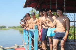
‘Oh and Nick we want muscle boys,’ added Christian so I had the onerous task of choosing 10 chiselled young men from my gym.
Getting Ready for the First Heat
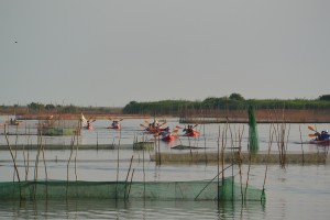
Our guests were the 120 staff from the Bill Bensley design studios in Bangkok, who’d been on the piss the night before and were reduced in number to 80 and somewhat subdued, excepting Bill. I tried to explain what we were going to do. That most of them didn’t speak English might have had something to do with it. Our buses pulled up at the Maichrey boat station where our fleet was waiting. I sensed their interest start to overtake the collective hangover as we motored past the little hilltop pagoda still with its clutch of attendant floating houses. We chugged in convoy down the narrow channel that cuts though the vegetation while the lake is full. Storks wheeled overhead and kingfishers darted from overhanging branches.
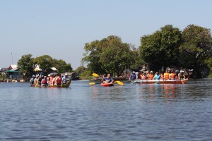
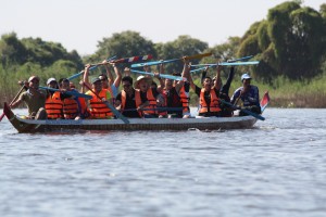
The Pink and Blue Team Race
We spied the race platform tied to the trees near the open lake and as we came closer WOW!! Whatever side of the sexual fence you sit, they were gorgeous. Clad only in shorts the full extent of the boys physiques were revealed much to the incredulity of the guests.
An Indochine Exploration Chauffeur
Chaos ensued made worse by me on the megaphone as we tried to assign all present into teams until I found out that they didn’t speak English and the message finally got through that they already had teams so Pink and Blue were first to race.
Making the assumption that an eskimo roll wasn’t possible in a Khmer racing boat an imminent capsize seemed inevitable as they boarded but amazingly settled 2 abreast they paddled the short way to where our Tony was waiting with his whistle in a motorboat at the start point.
A few beers and some rice wine later
Meanwhile our muscle boys waited beside their kayaks until Bill bagged Tiger then Taylor took Little Tee. ‘I need to take photos Nick.’ ‘Hmmm I thought as she settled snugly behind his rippled back.
The races had started – oohps. I fumbled for my phone and clicked on the stop clock. They’d got it! A rhythm of ‘Oi Oi Oi!!’ to power their strokes drifted across the water. ‘Blue!’ I screamed through the megaphone. Then it was Orange and Green. ‘Green!’ I screamed.
Bill and Big Tee
The muscle boys lubricated with a few beers and a bottle of rice wine (we found out later) had started to enjoy kayaking with or without the guests and in and out of the water. The same guests had relaxed and were chomping their way through Rinna’s buffet laid out on the wedding platform.
Blue – the Winning Team
The time had come for the grand final so Blue and Green, captained by Bill (with kayaking paddles) made their way to the start and somebody gave the go. A primeval collective grunt echoed across the lake as sophisticated designers found their caveman inside and strained on their paddles. ‘Blue, Blue, Blue!!! Yeay, we shrieked as they edged past Green (despite the kayaking paddles) and nudged the virtual finish line. Oohps no bonus this Christmas, Bill was Green.
Bill unnecessarily assisted by Tiger presented the winning team with 3 free nights at Shinta Mani and we bade them goodbye as they boarded the motorboats back to the buses and the hotel.
The grand prize – Tiger (presented by)
by Nick | Jul 15, 2018 | Blog, Conservation, Uncategorized
A Rwenzori Ramble
Uganda April 2018
Summary
Saturday 28th Depart London
Sunday 29th Arrive Nairobi and onward flight to Entebbe
Tuesday 1st May Fly to Kahihi and drive to The Ndali Lodge
Wednesday 2nd Chimp tracking Kibale Forest & Bird watching Bigodi Wetland
Thursday 3rd Morning drive to Kyambura Gorge Lodge and afternoon game drive in Queen Elizabeth National Park
Friday 4th Morning Chimp tracking in Kyambura Gorge and afternoon boat ride on Kazinga Channel
Saturday 5th Ishasha Forest game drive then transfer to Buhoma and Bwindi Lodge
Sunday 6th Walk to falls – birding in Bwindi Impenetrable Forest
Monday 7th Bird watching in Bwindi Impenetrable Forest
Tuesday 8th Drive to Kasese airstrip, flight to Entebbe then on to Nairobi
Wednesday 9th Nairobi – London
Friday 27th – Sunday 29th LHR 1755 KQ101 2J Arrive NRB 0430
‘You’re late,’ ‘No I’m not,’ ‘Laura said you’d be here at 4,’ Sally told me.
Since I’d orchestrated a hire car drop off, a Southern Rail journey – perhaps the most miraculous, lunch with Laura, an internet booked gym session then the tube to Charing Cross, I was a little affronted. Heyho it wasn’t finished yet, we had the Circle Line to navigate – destination the Barbican for Stravinski’s Right of Spring and followed by Rackmaninof.
The intelligent audience of nice looking people appeared to hear Stravinski as I might hear Hey Jude by The Beatles, I couldn’t translate. Rackmaninof was more approachable so when the pianists started shaking their shaggy heads and raising their hands above the keyboard I was with them.
As with Little Red Fox in Siem Reap for domestic adventures so it was with the Sky Team Lounge at T4 for the African adventure upon which I was about to embark “A Ramble in The Rwenzori”. I had been to see gorillas in Virunga last year (land of a thousand lakes – or was it hills – blog).
The supply of champagne was a touch on the parsimonious side and of course I got there too early but seat 2J wasn’t exactly slumming it. Willy Wonker and The Chocolate Factory was a moral tale with a gruesome ending for the revolting children or should have been except that Rohl Dahl and the directors took the soft option of having the horrible children and their ghastly parents resurrected. Of course Willy (not the wonker) wins because he’s modest, principled, polite and above all cute. The food was shit but better with Moses on the Embrauer to Entebbe and they had more champagne.
0655 KQ410 2A – ENT 0815, The Boma
 The Boma in Entebbe
I have a dread fear of queues and forgot my hat. East African airports have lovely air-bridges but they don’t use them so when we had to squeeze on an airport bus all men are created equal and being last off the plane because I forgot my hat, meant the front of the queue for immigration. Oh God my yellow fever certificate – back of queue. ‘E-visas this line,’ front of queue, the immigration officer walks away – back of queue. It didn’t take long and my bag was off first.
The faded salmon pink Boma Birding Boutique as it should be known, was not too perfect and generally lovely.
There’s a lot of people in Uganda and even more birds. I haven’t really been trying but they keep sitting and singing in front of me. Hornbills, weaver-birds (little vandals shredding leaves). Bulbuls, thrushes and finchy things I didn’t spot for long enough to identify. Ibis stabbed at the lawn, pied crows called raucously, black carrion kites soared. And then there was the Botanical Gardens beside the sea, well Lake Victoria but as good as. Egrets, cormorants, darters, pied kingfishers hunted along the waterline and rubbish birds or Maribou Storks scavenged in the park (adjutants in Cambodia).
Sweet Heart Coffee in the Victoria Mall – it reminded me of my early Cambodian assignations with Catrina on our escapes to Phnom Penh. I had a double latte, perfect timing as my legs felt like lead. It even has a gym – it will be part of the cultural experience to try it out.
Monday 30th
I’m not going at 7am! They haven’t bothered to find out where I am so I stamped my feet and spat the trolley out with the pram. Actually it’s mainly because I like Entebbe and wouldn’t mind staying longer.
 Hadada Ibis on the shores of Lake Victoria
An alarm bird, Fred told me is the local name for the weavers, penetrated my Valium induced coma briefly then I fell asleep again until my phone started ringing from somewhere under the bed sheets. I fumbled my way into consciousness slightly resentful of waking up until I realized I’d been asleep for ten hours and should feel good so I did.
It was bugging me. It sounded a bit like a hornbill, that sort of size but the beak was too small. It looked like a thickset magpie but according to my book, which is pretty thick, there aren’t any. I’d seen it eat fruit so the beak wasn’t a raptor’s, a coucal? nearly, an Eastern-grey Plantain Eater. The other species that had been bugging me was the brilliant crimson chested Black-headed Gonolek but it’s about the shape not the colour.
Prior to sweet heart coffee I’d noticed a gym. Two nights with little sleep, a nine hour alcohol fuelled flight/s then a long stroll round Entebbe meant it didn’t appeal yesterday but today was different.
Cameron was a UN helicopter pilot working in Southern Sudan and staying at the Boma. He drops food parcels on people’s heads if the isn’t planned well. There’s some big UN aircraft on the apron at the airport. He’d worked in PNG so lunch went quick such that I was late for Fred my bicycle guide.
Right said Fred – I had to get that in, ‘we’re going to cycle to the reptile farm, visit a homestay, the local town center, the ferry then back to the guesthouse.’ Fred’s 22, studying accountancy, works freelance for Bike2go and has no money as he kept, I’m sure truthfully reminding me. He’s lean, good looking and doesn’t smell much.
Fred told me about the church and the Chams – Muslims. He didn’t tell me about the government, which told me more though others later in the adventure did. His life, he’d split up from his girlfriend but had a ‘target’ in site. Dating, sex, marriage all ok but not to be gay.
Simon showed us round the SNCC a snake farm. It wasn’t a farm but a conservation project. Simon cared for his snakes and animals. He gave the tortoises calcium shots to help them repair their shells. As usual the snakes are an easy scapegoat and get beaten to death if caught unless the conservation message has got through, are still alive and somebody can be bothered to bring them to the conservation center. ‘The first bite they don’t inject venom, so its only when they keep getting abused that people get poisoned’ said Simon.
 Tortoise with damaged shell at SNCC (+ me)
The SNCC abutted the massive marsh I’d seen from the air. Simon told me it was inhabited by otters, duiker, snakes, etc but now could be reclaimed. Like the Botanic Gardens, where I could see the chunks that had been munched out for development.
Lake Victoria is vast. Arguably the largest lake in the world, of course the Americans claim that Lake Superior is bigger but Fred thinks they didn’t measure it properly.
Actually it wasn’t Fred. ‘Do you mind if I answer the question?’ A polite bystander enquired, compare that to Cambodia where a conversation is common property. ‘Where is Lake Victoria?’ I asked, which seemed like a stupid question as Entebbe is surrounded by it. He pointed in the direction of some storks (black open-bill) and pelicans to where a speedboat was heading out on the nine hour journey to Tanzania.
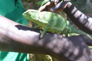 Chameleon on Fred’s arm
Tuesday 1st May ENT 1245 – Kahihi 1435, Ndali Lodge
Whisky in the tea hadn’t been a good idea, nice at the time but the next morning not so good as I contemplated the idea of getting up. ‘Was breakfast nice?’ Not very, I thought but said ‘alright thanks,’ which resulted in an awkward silence. Bugger the rain, I said to myself and got on a boda-boda back to the gym in Victoria Mall under an innovative umbrella that was positioned such that the motorbike taxi didn’t turn over at 40km.
The baby out with the bathwater had worked. George or Simon dropped me off at the airport. I wandered vaguely in the direction of where I thought the airplanes should be and met a lady who took me to meet a menacing security guard who sniffed my bag.
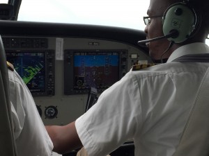 Simon flying us to Kahihi
Next stop a less menacing security man who wasn’t worried about my shoes, watch or belt. The lady said goodbye and George or Simon took me to a little bus, which sped across the Tarmac to my own Cessna Caravan where I met Simon and George who were going to fly the three of us to Kahihi.
It was a stunning flight. At 5000ft we flew under the clouds and dodged the weather systems I could see on the radar in front of me. Lake Victoria to the left and guess what Lake George ahead. A few buffets, a right turn for the final approach, a bumpy landing on the grass strip then we taxied to the little hut where I was laboriously but politely registered. Reassuringly a Volcano Safari’s Landrover was parked with Francis my driver and guide waiting. He appeared a clone of Robert the Rwandan guide last year. At least Francis knew his birds.
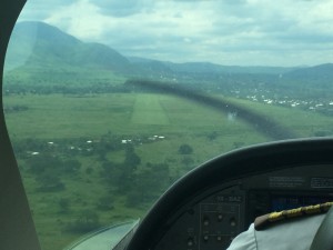 The landing strip at Kahihi
‘Why’s Ndali special?’ I asked Robert, I mean Francis. Special its jaw dropping! Aubrey and his clan own a thousand acres around a crater lake with views from the lodge to villages lining the rim and the lush mat of indigenous trees gripping the soil together on the steep hillsides. Looming above us to the West were The Rwenzori or Mountains of the Moon rising to over 5000m. So called because the early colonialists thought they were tall enough to touch the moon.
 Ndali Lodge
About my own age the couple on the table at lunch had been in Uganda for thirty years and had a farm also a house in Kilkenny. They’d come to Ndali to talk with Aubrey the owner about growing vanilla. ‘Who was he?’ I asked Simon the GM. ‘Dr Ian he has a hospital.’ Later I learnt he was Ian Black a Ugandan citizen, newspaper columnist and former Mayor of Kampala.
At breakfast that morning I’d met a lady who’s husband protects a national park in the DRC the size of Wales (they’re always the size of Wales), home to 47 giraffe at risk from Sudanese poachers who shoot them for their tails to be used as flywhisks. They also prevent the poaching of 1300 elephants.
 Crater lake to the East
‘Three hours to walk round the lake,’ said Francis but Simon (maybe George) and I took one hour.
My own plane, my own lodge – there’s no one else staying here, a candelabra with flickering candles on the table, William the barman and Grace the waitress. An overload of experience which is more than I can process tonight.
 Holub’s Golden Weaver – seen walking around the crater lakes
Wednesday 2nd Chimp tracking in Kibale Forest & bird watching in the Bigodi Wetland
I eyeballed two species of monkey today. First Totti who wasn’t giving anything away and stared back with distant black eyes, then a Red Colobus looking at me from a branch above. Human like but at the same time unsettlingly alien. Endemic to Uganda they like rotten fruit, which ferments in their stomachs. They get drunk and pick a fight with the chimpanzees who eat them. The chimps were the main attraction but more on them in a minute.
 Crater lake to the West
The clocks are about an hour out in Uganda, great because I’m still writing this outside at 7pm when the equator is just a 100km to the South. It does mean that the wakeup tea was delivered in pitch darkness and breakfast taken with the East door open to let in the light. My table was positioned to watch the sunrise but it was late this morning and Francis and I were on the road before the sun was up.
Subsistence agriculture shapes a diverse landscape. A patchwork of small fields surrounded by useful trees and shrubs. It’s not quite as intense as Rwanda but most contours are farmed. Cambodia the land where the bong thoms* roam is increasingly agri-industrialised leading to endless horizons of uniformity. The pockets of subsistence farming left are picturesque but it wasn’t a one sided story. There were ring barked trees and the intensity of agriculture and diversity of landscape could only happen because of the soils fertility.
*kindly described as influential politicians and business people
Kibale Forest; mysterious, magical and full of fantastic life. An African-grey Parrot flew in front of the Landrover. We stopped to watch Olive Baboons. There’s thirteen species of primate marooned in this enclave of biodiversity previously connected with the great jungles of The Congo.
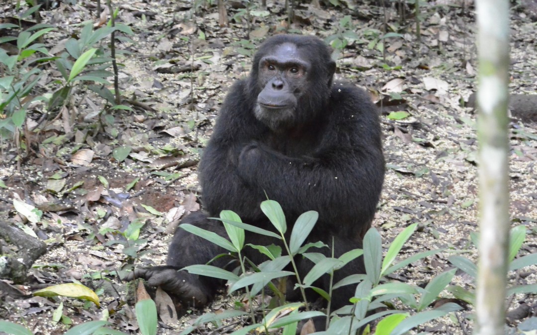
We had to walk. Francis told me it was a short distance but three hours later we were still going. Bosco our guide who identified birds from calls I didn’t even hear (assuming he wasn’t making it up) and another couple from Chile. The first sign of a chimpanzee was a mound of poo, ‘they’ve got diarrhea.’ ‘It’s a Scaly-breasted Eradopsis,’ Bosco said. ‘Is it painful?’ Finally black bundles in the treetops then a crash as one descended and ran along the path where I was standing. Totti the alpha male 55 kg of muscle chasing Tifu, his ‘target’.
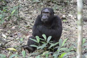 Totti, the alpha male
We followed fast behind attempting to snatch a photo on the run, ‘keep going until they sit,’ said Bosco so we ran until Totti sat. The violence and drama temporarily dispelled as he sat in quiet contemplation while I anthropomorphized, looking in his black eyes and wondering what he was thinking about. Gorilla like he lay stretched out and scratched his balls (photo below).
Nelson in The Bigodi Wetlands also knew what he was talking about. Within 500m we had ten new species of birds. Bigodi was swamp forest surrounded by maize, tobacco, coffee and cabbages. ‘Does eco-tourism make a difference?’ I meant that with the intensity of the surrounding agriculture does it help to relieve pressure on the small reserve. He said it did. It’s all green but on our left Bigodi and an incredible array of shape and form and on the other a monochromatic uniformity.
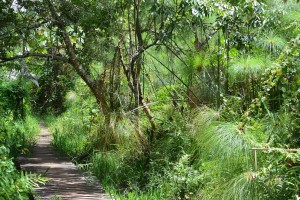 The Bigodi wetlands
So many birds but the monkeys were lacking save for some shaking branches. We followed a track into the swamp to see trees festooned with Red Colobus, closely followed by a Grey-cheeked Mangabe. There were Black and White Colobus in the trees at the edge of the farmland, plus the Olive Baboon, Red-tailed Monkey and Chimpanzees we’d seen earlier meant six species of primate today. FYI colobus means missing which makes sense as colobus monkeys only have four fingers with no opposing thumb.
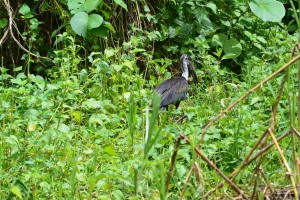
African Open-bill Stork & Black & White Colobus
Thursday 3rd am Transfer to Kyambura Gorge Lodge. pm game drive in Queen Elizabeth National Park
I didn’t think I’d slept well but surfaced from a full-on dream as Nelson knocked with morning tea. Not cold but nice under the covers, I watched the mountains turn a dusty pink. Suzu was lying by my bed, she’d been there all night. A friendly, rangy hound, her sister was outside.
Sleep assumes an even more important role than normal on a holiday like this because of the difference between being able to ride on the wonder of what you see or just being overwhelmed.
 Queen Elizabeth National Park from my banda at Kyambura Lodge
It was downhill all the way as we descended from Ndale back past Kahihi and the strip where we’d landed all those hours ago, crossed the equator, we’re now in the Southern Hemisphere, and entered the Queen Elizabeth National Park (QENP). I thought Francis was joking when he said hippo but sure enough in a wallow beside the road a muddy mound with two eyes stared back. We spotted Kob antelope in the distance, the Ugandan national animal.
Statistics; its 2000 km2 though seemed bigger when we were driving to Bwindi. There are 2000 hippos that weigh up to three tonnes, 140 lions (out of only 400 in the country), leopards, hyenas, chimps, 400 species of birds, etc. and the lodge. I have to pinch myself, first the West and now the East side of the Great African Rift Valley.
My banda is called Brutus and looks out over half of Africa. Et tu Brute, probably a knife in the back from the dance troupe stamping a war dance in reception (a sort of African version of morris dancing) but OTT after the drive.
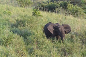 Elephant below the lodge
It’s becoming a spoilt boys obsession to avoid being over pampered or overfed. ‘You only want that?’ like I’d committed a cardinal sin at breakfast when I only ate muesli. My new butler – yes get that, at The Kyambura Lodge wants me to eat and drink so that she’s got something to do. Instead its becoming a mission to avoid Peace – is there something profound here, that’s her name! So looking right and left I furtively closed the door to my banda, and took a small path so I could run undetected.
It seems right is right in Africa, usually I go left but this time right up the hill past a lot of children shouting mzunga, that’s me. Near the top I looked down to two crater lakes and gratifyingly my track connected with the road we’d come on so it was a circular run and right was right.
 My banda
Friday 4th am Chimp tracking in Kyambura Gorge. pm Kazinga Channel wildlife from boat
The QENP a vast grassy expanse roamed by elephant bisected and by a slash through the middle bursting with life, The Kyambura Gorge is as unexpected as its magical. One of the most beautiful places I have ever seen.
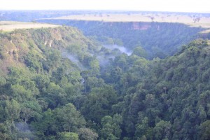 The Kyambura Gorge
Lazarus or Edward led us with the obligatory gun down a muddy path that descended to a fast flowing brown river. The canopy now high above us enclosed a prime-evil world of snorting hippos and screaming chimps.
The foliage was so thick that we meandered beneath the canopy between tree trunks and hanging vines waiting for our eyes to become accustomed to the gloom.
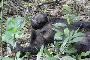
A few minutes later we saw our first black bundles. The dominant male ran down the tree like it was an airport travelator. He beat the buttress of the trunk like a jungle drum, barred his teeth and screamed violently.
Another male in a distant part of the forest screamed back. Dominance asserted our male lay on the floor, crossed his legs and contemplated the sky.
This time I could see the colour of his eyes, brown in an expressionless face. ‘Do they show emotion?’ I asked Edward. ‘Yes, anger, excitement, pleasure.’
The big male was part of a group that hung around this part of the forest where fruiting fig trees grew. A primates paradise that other chimpanzee groups would like but human encroachment had cut them off resulting in an isolated gene pool. ‘We want to open a genetic corridor with fig trees up and down the gorge connecting the populations.’
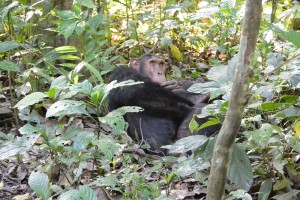
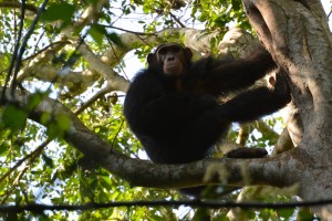
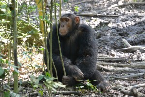 Left and above the Kyambura Gorge Troup
I hadn’t slept well for worrying about unraveling relationships then ‘Good morning, good morning,’ Peace was singing as she bought my morning tea. ‘Oh shut up.’
A Mexican family were staying at the lodge, they’re tour operators, went to Pure in 2017, had an appointment with Smiling Albino and I recognized the two sisters.
Francis’s Landrover, technically mine for the week had broken down, so I went with the Mexicans to the Kazinga Channel. A forty kilometer stretch of water connecting Lake George with Lake Albert, surrounded by the Queen Elizabeth National Park (you’d never know the British had something to do with it).
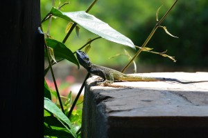 The restaurant terrace at the lodge
The countryside was dominated by candelabra cactus, invasive aliens that were being knocked down at one site by a CAT. The elephants do it for fun.
The metal tourist boat was a bit of a let down after all the personal pampering but the bird life was prolific. James this time, helped me to identify twenty seven species but it wasn’t just the birds …..
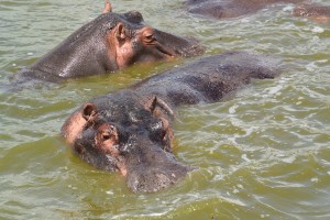
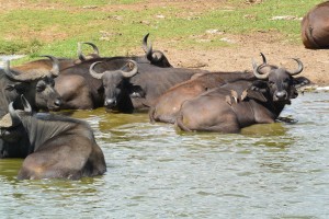
Hippo and Water Buffalo (with Oxpeckers) in the Kazinga Channel
The Yellow-billed Oxpickers were busy stabbing ticks on the back of submerged water buffalo. Massive swirls appeared beside the boat followed by the great grey bulk of hippos, showing off their impressive dental kit and beady, angry eyes.
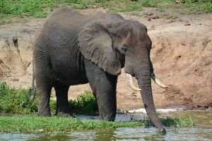
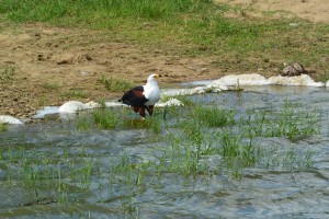
Residents of the Kazinga Channel, Elephant & African Fish Eagle
A small group of elephant scratched against a Mopani tree and a crocodile tossed a thrashing tilapia in its jaws then swallowed it whole. Warthogs knelt down to graze ‘because they’ve got weak necks,’ James said. Pied Kingfishers were perched on every vantage point and flying into holes in muddy cliffs along the shoreline. They dig to escape the monitor lizards, or it could be the monitor lizards dig holes to catch the Pied Kingfishers. On cue the culprit appeared, a meter long lizard.
At the confluence of the channel and the lake a sandy beach was crowded with plovers, geese, gulls, cormorants, pelicans, Ibis and a dainty hippo grabbing a quick graze before sinking into the support of the soothing water.
A park boundary defined fishing village, allowed because it was there before the park was gazetted, lined a low ridge. My gaze moved to where three young men stood washing themselves in the water. I looked again and saw they were naked, washing each other and er well endowed. ‘Hmm’ I thought, Central Africa’s not totally un-homoerotic.
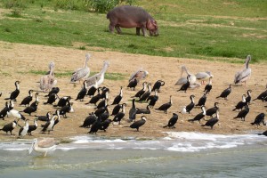 Young hippo and water birds along the channel
Saturday 5th Ishasha Forest game drive and transfer to Buhoma and Bwindi Lodge
The pastel colours of the park changed. The gorgeous surreal suggestion became reality as I contentedly gazed from the comfort of my large bed sipping Peace’s tea (it was a teabag not proper tea!).
 The Ishasha Forest (there were some more trees)
Driving South for five and a half hours, most of it through the QENP. A vast expanse of empty space with few people, bordered by Lake Edward and the Virunga Mountains, beyond the mysterious and brooding Congo. ‘If Mr Praveen (the owner of Volcano Safaris) opens a lodge I’ll go there,’ I told Francis. Meanwhile UK tourists to the DRC Virunga Park were being kidnapped and ebola’s broken out, I later learnt.
It’s a bird watchers paradise, nearly 400 species in the QENP alone. I’ll list the birds and animals I’ve seen in an appendix to the blog. Vervet monkeys peered out from the undergrowth. The trees were festooned with Black & White Colobus and Olive Baboons roamed the roads.
Hammerkops are undistinguished birds with bad hair. They make up for it by building enormous nests. It’s an obsession.
The tree-climbing lions of Ishasha were out to lunch. They certainly weren’t on any of the horizontal fig tree branches, their usual daytime hangout, that we searched for across the plains in our long wheel based Landrover. We had a picnic beside the Ishasha River joined by snorting hippos then set off for Bwindi, narrowly avoiding mating Kobs. ‘I don’t need Kob porn,’ I told Francis so we left the grassland tracks for the main – dirt – road. And returned to world of humans separated from that of animals by a two meter deep trench.
In the rising mist Bwindi lives up to its name and looks impenetrable. I’m in Bob’s bungalow, that’s the name of the room, looking across the valley at a wall of green as the forest climbs the steep hillside broken only by the trunks of the tallest trees. Gorillas were here this morning. I’ll put out a glass of Sauvingnon in the hope they return. The colobus were content with fermenting fruit and picking fights with the chimps.
Sunday 6th Walk to falls – birding in Bwindi Impenetrable Forest
The breakfast room at the lodge butts out over lawns carved from the forest at the edge of the national park. The staff seemed particularly excited about something then Adolf beckoned me to follow with a conspiratorial smile. A family of gorillas were having breakfast, eating the vegetation in a clearing below the lodge. Transfixed and awestruck I stayed until a park ranger appeared shoeing me away – I didn’t have a $600 pass.
Tropical rainforest with a thirty-meter high canopy, towering giants clad in shrouds of moss and lichen, shafts of sunlight illuminating the delicate fronds of ferns. We followed the lively Munyanga Stream upstream. The lit translation is the grabber. It washes away and grabs the crops along its banks as it flows down to a river.
The source is a spring thirty kilometers up the valley but still inside the park, hence the clarity of the water.
Villagers strolled up and down the path but still we needed two armed guards, no doubt in case of racist elephants. O’Max my guide tried to sell me hiking and tour arrangement in Uganda when I told him I ran a tour company, which has a serious appeal, excepting the gay issue.
 The impenetrable forest
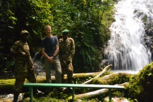 The Munyanga Stream
An enchanted path loops below the lodge, down to the river where a trickle of crystal clear water flowed. A bronze coloured duiker (Black Throated) didn’t hear me long enough for me to catch a glimpse. I seem to keep finding naked Africans, men, that is and well endowed. I suppose its because in general the women are large and the men small so they need a large cock to bridge the gap.
‘Pick’ said Fred so Anus and Dorythea decimated a tea bush plucking the top two leaves and central bud as Fred kept reminding Adolf and I, though I don’t suppose Adolf needed reminding as being a butler, mine I later found out, he’d heard it before. The bits of bush were tossed into a basket with large holes so consequently fell out. At a small hut Fred told Anus to use his pestle and grind the leaves to a mush. ‘Fire’ said Fred so Dorythea heated the mush until it was dry. ‘Sieve’ said Fred so Anus sieved it until something approaching tea was collected. Green tea is steamed and not fired. ‘Drink’ said Fred, sorry I mean would you like a cup of tea? ‘Yes please, black,’ it seemed appropriate and was very good.
Adolf made me wake up tea the next morning, ‘where’s the milk?’ ‘Innit,’ said Adolf. It was African tea, ginger, bay leaves, cinnamon and milk, which after I’d got over the surprise was delicious.
Monday 7th Bird watching in Bwindi Impenetrable Forest – day 2
We walked to the border of the park and the DRC, twenty-six kilometers. ‘It’s a long walk,’ said Francis but he hadn’t mentioned 26k. ‘Hmm,’ I thought as he introduced me to Nicholas.
The forest trail is a local highway but we had to have the obligatory two guards and AK47’s. The obligatory two guards realising we were walking to the other side of the park bailed out and had to be replaced.
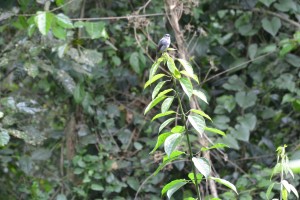
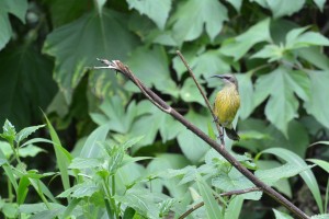
Flycatcher (above) and sunbird right
Francis had oversold me to Nicholas who thought I was a hard-core fanatic and let loose with his twitching tendencies. Little brown jobs silhouetted in the gloom is not really my kind of bird watching. ‘Its an immature Black Bee Eater,’ said Nicholas as he pointed with his green light saber. ‘The only thing we can agree on is its black and barely indistinguishable from the leaf it’s sitting on,’ I thought.
It started to rain ending any pretensions of bird watching for me, ‘its only another hour,’ said Nicholas. ‘Another hour to what?’ ‘Till we get there,’ ‘what happens then?’ ‘We come back.’ The logic inescapable, the appeal not great but we’d come this far.
The end of the trail was a suspension bridge over the River Ivy. It was like walking on ice unexpectedly so my feet disappeared from under me and slid over the side, luckily I managed to grab onto the bridge. On the other side of the river a grassy valley and a lot of birds having a break from the impenetrable forest.
The biodiversity is phenomenal, apart from the headline species; gorillas, chimps, elephants, colobus monkeys, there’s thirty odd species of endemic birds, some critically endangered of which I saw three. Forty species of endemic butterfly and maybe mammals, Nicholas wasn’t sure. An ancient island cut off from the once vast and still pretty big forests that extended across central Africa and covered all of Congo.
My barely functioning legs felt like lumps of lead as I limped out of the park entrance and made straight to the Bwindi Bar. A couple of Nile Specials and humanity returned.
Four dusky slate blue warblers sat under a yellow flower fluffing up their feathers and preening. Bulbuls hoovered up insects as they rose from the sodden vegetation and the dense forest disappeared as cloud advanced up the valley. Dusk was giving way to night as I wandered my weary way to dinner.
It all started with Rackmaninof & Stravinski, it’s not quite finished yet, where will it end ……….., read on.
Tuesday 8th & Wednesday 9th return Transfer to Kasese 0945 – ENT 1125. ENT 1720 – NRB 1830 KQ415 2A, The Lazizi Premiere NRB 0920 – LHR 1615 KQ100 2A
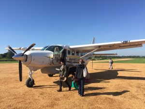 Boarding our Caravan at Kasese with Noemi, the Mexican tour operator
I had a dream, which meant I slept well. Unusually I could remember a little bit, about going into a suspended animation and just as I was about to wake up Adolf woke me with his African tea. It was still black at 6 but a glimmer of light penetrated a quarter of an hour later and by 6.45 I could see the valley.
The weaver-birds are bit like the hammerkops in that they’re obsessed with their nests and fly backwards and forwards carrying tails of grass adding to its construction.
The light was sparkling in the damp from yesterday’s rain, the valley bottom filled with mist and now sunshine bathing the hills on either side. I didn’t want to go. Even Francis and I had become buddies.
The Cessna Caravan landed shortly after we arrived at the Kahihi airstrip and we squeezed in with some Americans, flying back the journey we’d driven down. Over the Ishasha Forest, the plains of the QENP, the Kazinga Channel with the Kyambura Gorge in the distance. Even over the London Bridge imported for the Queen when she opened the Park. Lake George on one side and the Rwenzori on the other as we took off for Entebbe. A full hours flight despite my thinking it couldn’t be much more than a three hour drive. I would have been enjoyable except I needed a piss – badly by the time we got there.
I found a taxi at Entebbe who over-charged me but not badly after we’d bargained a bit, got to the Boma. I had three hours so got changed picked up a boda-boda, went to the Victoria Mall gym for an hour. Had a chilled lunch and spotted yet another species of bird. ‘We’re vegan would you like our garlic bread?’ ‘Of course you are,’ I thought. An American mother and son – or toy boy (I don’t think she was that interesting) asked. I bought a book on mammals at Entebbe airport and watched an enormous Emirates 777 take off.
Totally unnecessary but rather fun, I was the only one at the front of the plane with a glass of champagne safely installed beside my seat. It was like the good old days on the way to Frankfurt when I managed to get in five little bottles of Piper Heidsick before touch down.
It was fitting that the Crowne Plaza at Nairobi Airport was horrible on the last night. I had a burger without the bun, in a bland eating space watching a screen repeat the benefits of the bland hotel. The contrast with exciting lodges on the edge of the wild was absolute.
Work invaded; Tigers pissed off Christian, who knows if we’ve got the JPA school on a BeTreed trip. What Buntha and the rest of the Chheangs are doing is questionable, Manus sent me a nasty message and Own is ill.
And one more species, we’d seen the Crested Crane on the way to Bwindi and a Wooly-necked stork on the way back. A magical place set in a magical country.
Appendix 1. Bird List
Boma
- Hadada Ibis
- Ring-necked Dove
- Eastern Grey Plantain Eater
- Common Bulbul
- African Thrush
- Red-chested Sunbird
- Black-headed Gonolek
- Black-headed Weaver
- Ruppells Long-tailed Starling
- White-browed Robin Chat
Entebbe
- Great White Pelican
- African Open-billed Stork
- Cattle Egret
- Little Egret
- Maribou Stork
- Pied Kingfisher
- Black Kite
- Pied Crow
Kasese
- Black-headed Heron
- Grey-backed Fiscal
- Laughing Dove
Ndali
- Pink-backed Heron
- Cinnamon-chested Bee-eater
- Common Waxbill
- Grey-headed Sparrow
- Ross’s Turaco
- Great-blue Turaco
- Crowned Hornbill
- Pied Wagtail
- Red-billed Firefinch
- African Harrier Hawk
- Holub’s Golden Weaver
Kibale Forest
- Grey Parrot
Bigodi Wetlands
- Black and White Casqued Hornbill
- Copper Sunbird
- Splendid Starling
- Purple-headed Starling
- Woodland Kingfisher
- African Pygmy Kingfisher
- Pin-tailed Whydah
- Black and White Mannikin
- African Blue Flycatcher
- Black and White Shrike Flycatcher
- Bocages Bush-shrike
- Red-headed Malimbe
- Speckled Tinkerbird
- Yellow White-eye
- White-chinned Prinia
- Little Greenbul
- Western Nicator
- Southern-red Bishop
- Tambourine Dove
On route to QENP
- Lizard Buzzard
- Red-eyed Dove
- Yellow-billed Kite
- Long-crested Eagle
- Speckled Mousebird
Kyambura
- African White-backed Vulture
- Vieilott’s Weaver
- Yellow-fronted Canary
- Bronze Sunbird
- Northern-black Flycatcher
- White-headed Saw-wing
- Common Scimitar-bill
- Yellow-chested Sunbird
- White-browed Coucal
- Lesser-striped Swallow
The Gorge
- Grey-headed Kingfisher
- Common Buzzard
- Ring-necked Francolin
Kazinga Channel
- Egyptian / Nile Goose
- Yellow-billed Stork
- Grey Heron
- Spar-winged Lapwing
- Hammerkop
- White-winged Tern
- Yellow-billed Oxpicker
- Black-winged Stilt
- Common Greenshank
- African Skimmer
- Water Thick-knee
- Sacred Ibis
- African Fish-eagle
- Palm-nut Vulture
- Black Crake
- African Jacana
- Yelloueenw-backed Weaver
- Red-throated Bee-eater
- African-wattled Lapwing
- Great-white Egret
- Red Cormorant
- Great Cormorant
- Gull-billed Tern
- Lesser Black-backed Gull
- Grey-headed Gull
QENP
- Helmeted Frankolin
- Red-necked Spur Fowl
- Fork-tailed Drongo
- Arrow-mapped Babbler
- Yellow-throated Long Claw
- Blue-naped Mousebird
- Fan-tailed Widow Bird
- Grey Kestrel
- African Green Pigeon
- Sooty Chat
- Red-rumped Swallow
- Martial Eagle
- Bateleur
- Madagascar Bee-eater
- Flappet Lark
- White Stork
- Rufous-necked Lark
- African Fire-finch
- Grassland Pippit
- Common Sandpiper
- African Grey Hornbill
- Black & White Cuckoo
Around Bwindi
- Auger Buzzard
- Grey Crowned Crane
- Wooly-necked Stork
Bwindi Impenetrable Forest
- Short-tailed Warble (an endemic species and critically endangered not see but heard)
- Mountain Wagtail
- Blue-headed Sunbird (endemic)
- White-tailed Crested Flycatcher
- Yellow-rumped Tinkerbird
- African Blue Flycatcher
- Tiny Sunbird
- African Paradise Flycatcher
- Northern Double Collared Sunbird
- Grey-headed Sunbird
- Olive Sunbird
- Bar-tailed Trogon
- Elliot’s Woodpecker
- Brown-capped Weaver
- Black-crowned Waxbill
- Yellow-fronted Tinkerbird
- Grey-throated Barbet
- Mountain Illadopsis
- White-tailed Ant Thrush
- Equitorial Akalat
- Red-faced Warbler (endemic)
- Olive-green Caneroptera
- Red-tailed Bulbul
- Dusky-blue Flycatcher
Appendix 2. Mammal List
Kibali Forest
- Common Chimpanzee (and Kyambura Gorge)
- Central African Red Colobus
- Olive Baboon (and throughout trip)
- Grey-cheeked Mangabe
- Vervet Monkey (and Bwindi)
- Red-tailed Monkey (and throughout trip)
Bigodi Wetland
- Black & White Colobus (and Bwindi)
QENP
- Ugandan Kob
- Bush Elephant (also Kazinga Channel)
Kazinga Channel
- Common Warthog (and Ishasha Forest)
- Common Hippopotamus (and QENP)
- Cape Buffalo
Bwindi
- L’Hoest’s Monkey
- Mountain Gorilla
- Black-fronted Duiker
by Nick | May 31, 2018 | Angkor, Blog, Uncategorized
Introduction
Angkor is an amazing place. You cannot fail to be impressed even stunned by the grandeur, detail and scale of the monuments. The true wonder of the Angkorian Empire and what it achieved has only started to dawn on me in the last few years. It was when the findings of the Lidar survey surfaced that I grasped the extent of what was one of the world’s greatest civilisations.
Lidar in layman terms emits an electromagnetic pulse i.e. a laser, that is strapped to a helicopter and fired as it passes over the ground to be surveyed. The reflected light is fed through the software that strips away the vegetation to show the topography and reveal previously unidentifiable structures.
The results are phenomenal! Phnom Kulen had a city on top. Angkor Thom was laid out in a grid of roads and canals framing wooden houses and their trapaeng or pools. There were thousands of temples not hundreds, and it was all made possible by the management of water in a climate where at the best of times 6 months of rain is followed by 6 months of drought.
I also began to realise that many of our cycle routes, hiking trails and even kayaking adventures followed these ancient waterways. I’d heard Roland Fletcher give fascinating talks at Amansara and on the banks of the West Baray. It wasn’t until Damian Evans (also from Sydney University) spoke to the guides that I knew he could tell us what we needed to understand Angkor.
The Water Connection
Boeung Ta Neue – our Secret Lake where we kayak, was an Angkorian reservoir formed by an extension of the North Wall of the East Baray, a much larger reservoir connected with the Angkorian cities of Ta Prohm and Angkor Thom. Boeung or lake Ta Neue caught the rain run off from the Kulen Hills to the North, which fed the Baray and in turn the conurbations of Angkor.

Kayaking on Lake Ta Neue
Nearby the corner of the East Baray, where we discovered a wall separating the Baray from Lake Ta Neue, is the 7 arched Spean Tor Bridge. Clearly visible by kayak from the water, we managed to reach it through the bush. We searched on the Baray side for a connection with Lake Ta Neue but none was to be seen. We couldn’t work out the purpose of the bridge though to be sure a thousand years ago it had one.
![]()

Spean Tor Bridge
The main water flow in and out of the East Baray was through Kral Romeas, a sluice built into the banks of the East Wall. Cycling and hiking through Phum Samre, the village that lines the walls I’d noticed large laterite stone blocks. Closer inspection revealed 1 large thick wall and 30 metres away another running parallel. These formed the sides of the sluice, the raised ground in front of us was a laterite weir. Kral Romeas acted over time as an inlet and outlet to the East Baray and may have been connected by another laterite wall running parallel with the East Bank, to Lake Ta Neue via the bridge Spean Tor.
An outlet has also been discovered opposite in the West Bank at the far end of the Baray, which provided water for the wooden houses between Angkor Thom and fed into the Ta Prohm moat. 7km long and 2km wide the Baray seems to have been a huge body of water to supply what appeared as a compact area of habitation but it would also have been used for irrigation.
Damian put this into context by working out that the 50 million litre3 in the West Baray reservoir of similar size to the East Baray, could provide irrigation for 5000 ha of rice, perhaps 10,000 tonnes for each crop. The rice fed a population of hundreds of thousands of priests, the aristocracy and merchants who lived in and around the ancient temple cities.

The West Baray at the end of the rainy season
It was also unlikely that the 3 great water reservoirs of the West, East and North Barays were in simultaneous use but acted as a safe-guard for times of drought and flood.
The scale of these man made hydraulics are unparalleled in human history and mind-boggling. To truly understand you have to think about the 3 spatial dimensions in combination with a 4th dimension – time, the chronology of the kings and climate. History seems to have been determined by the weather as the peaks in the empire, first during the reign of Suryavarman II in the 12th century and second under Jayavarman VII in the 13th century coincided with the peaks in rainfall we saw from the ancient records on Damian’s computer screen.
The ultimate decline of Angkor was also linked to periods of extreme drought followed by flood years, which washed away this finely tuned hydrological infrastruture needed to supply water during the dry season and get rid of it during the flood. This is most clearly seen at Spean Thmor near Angkor Thom where the old bridge lies high up the banks of the Siem Reap River, which now runs meters below.
Prasat Tor (prasat meaning temple) and Troung Chruk (pigs temple) it’s ruined sister temple to the South lie between Lake Ta Neue and the East Baray next to an unexplained mystery, a 10 x 10 grid of a 100 mounds.
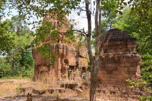
Prasat Tor and it’s 3 laterite towers
Similar grids have been found beside the River of a Thousand Linga’s, Kbal Spean at the West end of Phnom Kulen and Sambor Prei Kup near the modern day city of Kampong Thom, both associated with major water systems. No artifacts or remains have been unearthed to help solve the mystery of what the mounds are.
Walking across where the grids were revealed by Lidar, we spotted fragments of curved roof tiles in a papaya plantation that in an act of unintended vandalism, has been planted right over the mounds, which may help solve the mystery.
Most of what is known about Prasat Tor comes from a 4 sided stele (a stone pillar with carved enscriptions) discovered by the French in the 1930’s and now stored in The Angkor Centre for Conservation. The Sanskrit engravings were translated and available on line, which Damian translated for us in his office that morning. The stele had been installed by a Brahmin priest during the 13th century referring to the Great King Jayavarman VII. The inscription mentions the Ganges River in association with water, which may have had something to do with the Kral Romeas sluice and was the same as an inscription found at Phnom Dai temple to the North, also the site of another grid of mounds. The temple itself appears to predate the stele and may have been built at the same time as the 10th century East Baray.
Randomly cast on the ground around Prasat Tor were the now eroded but once richly carved blocks that adorned the structure including the stone crown that sat atop the central tower. Interestingly it had a hole in the middle, where a bronze finial in the form of a trident could have been positioned. Possibly removed at certain auspicious times of the year to bathe the Goddess Shiva sitting 15 meters below in sunlight.
Now set amongst brilliant green paddy fields in November, on the other side of Lake Ta Neue is Leak Neang Temple dated to the 10th century. A stele has recently been removed from the site to the Angkor Conservation but has yet to be translated.
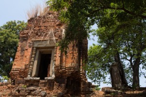
Leak Neang with its single brick tower
The bricks themselves are another mystery as no kiln has ever been found. A theory speculates that the bricks were fired close to the temples then used in it’s construction. The apparent black scorching seen on the walls seemed to support this idea.
Not only was this masterly management of water used to supply The Angkorians and irrigate their crops, it was also conveyed the enormous amount of stone required to build the temples. Laterite is an iron rich clay that is soft and easy to dress into blocks when it comes out of the ground. On exposure to the sun it becomes very hard but relatively light making it ideal for the foundations but not the decoration as its pock-marked surface is not easily carved. The laterite quarries lay in the hills to the West. Dams collected water from streams, which was released into the Great North Channel that carried the stone blocks South to Angkor.
At the Eastern end of the Kulen escarpment were quarries that supplied sandstone, which was carved into the marvelous facades of the temples.
A channel ran from Beng Melea past the Temples of Banteay Ampil and Chau Srey Vibol to Prasat Batchum inside Angkor. A path still connects these sites and makes for a great cycle ride with temple stops for sustenance heading East to the Tamarind Temple – Banteay Ampil.
We were beginning to get a handle on the Eastern end of the water connection, now it was time to explore the Western end. The Siem Reap River flows South from the Kulen Hills to the the city and then onto the Tonle Sap Great Lake but during Angkor it was diverted into the North East corner of the Angkor Thom Moat. History is being repeated as subsequent to the floods of 2011 the channels have been reopened and another dug in parallel on the North side of the moat as the river is diverted into the West Baray with the aim of stopping the floods in Siem Reap. The fact that now the town of Puok to the West floods instead is not part of the discussion – tourists don’t go there.
Angkor Thom was Jayavarman VII’s and his 2 wives, city. The largest of all the Angkorian Cities its wall’s 3km long enclose 9 km2, which is now mainly forest but once housed a thriving metropolis of wooden houses and their trapeang, surrounded by a grid of canals and roads as the Lidar survey revealed.
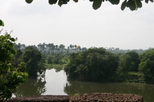
View over the moat from the walls at the S.E corner of Angkor Thom
The data was detailed enough to show the individual houses, which can be extrapolated to give a guessed population of 70,000 based on an assumed family size. This would need a lot of water but during the rainy season any excess flowed out of Boeung Thom reservoir in the South West of the city and through Runta Dev a canal that runs under the city walls into the Angkor Thom moat. We’ve got a stunning cycle route that runs along the 8m high walls of Angkor Thom to Prasat Chrung or corner temple – there’s one at each corner. A great late afternoon spot for watching the sun set over the moat, paddy fields and palm trees beyond. We didn’t realise the engineering marvel that lay 8m below us until Damian lead us down the inner banks to a stream that on closer inspection disappeared into a laterite tunnel under the walls and out to the glinting light of the moat 30m away.
The West Baray 500m to the West is one more mystery. How was this vast body of water replenished and released during times of flood? The current outlet of the Angkor Thom moat is a canal running parallel with the road through the West Gate dug by the French, which destroyed any trace of what was there before. It is possible it was a replacement otherwise how did 50 million litres of water get into The Baray.
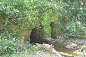
Runta Dev runs under the walls of Angkor Thom
What had we learnt that morning?
We understood that water running off the Kulen Hills to the North fed streams, which flowed into the reservoir / lake of Beoung Ta Neue in turn feeding the East Baray, which was a water supply for the population of Angkor Thom and Ta Prohm.
Damian confirmed that our cycling path to Chau Srei Vibol and on to Banteay Ampil, lay along the route a canal had taken bringing sandstone from the quarries at the Eastern end of the Kulen escarpment via Beng Melea to Angkor.
He explained how the laterite used to build the foundations of the J VII temples were carried by water released into the Great North canal which flowed to the North Baray and Preah Khan.
And the Western hydrological connection was made by the Siem Reap River coming from the Western end of Kulen flowing South into the Angkor Thom moat and maybe on into the West Baray.
And much else besides!
With great thanks to Damian Evans for a really fascinating morning and apologies for any misinterpretations.
Indochine Exploration with Smiling Albino Cambodia is pleased to take our guests on a introductory investigation of the main temples along the water courses described or an adventure to experience this incredible landscape on foot, by bicycle or kayaking.
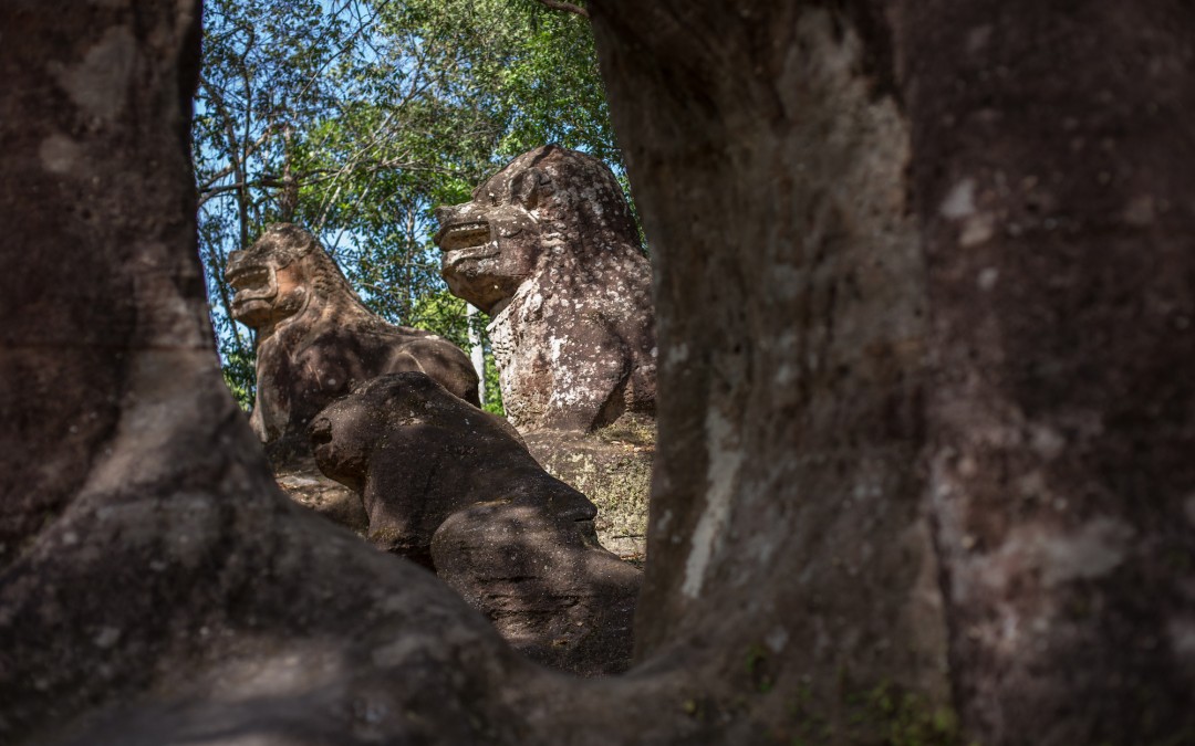
by Nick | Feb 26, 2018 | Bike, Blog
A Kulen Mountain Bike Temple Odyssey
Phnom Kulen lit Kulen Mountain or Mountain of The Lychees is our mountain bike playground, bisected by the Kulen super highway (in fact a red earth road), which climbs the mountain at the Western end. Runs to the central tourist village of Preah Ang Thom and continues to the Eastern escarpment above the town of Svay Leu. It’s crisscrossed by routes across the rocky plateau, forest paths shaded by canopy 10 meters above, sandy tracks that turn instantly to mud whenever it rains and dry trails through the cashew nut plantations.
The plateau was isolated until the end of last century. Floating 500 meters above the Siem Reap plains and still harboring remnants of Khmer Rouge in what must have been thick forest across the 40,000 hectares of hills.
And you’ve got JII (Jayavarman II) and his God delusion that lead to the whole Angkorian business, which inevitably meant a lot of temples that over the centuries got overtaken by jungle.
We follow the main road from Siem Reap to Banteay Srei Temple past the palm sugar sellers who line the way. I admire their optimism of demand for palm sugar. We climb the escarpment and enter a cool green filtered light as trees close branches above the red earth road and shut out the dusty badlands we’ve left behind.
It all started 1200 years ago in the river, where JII crowned himself emperor of the world, as they knew it then. To mark the spot he left a ..
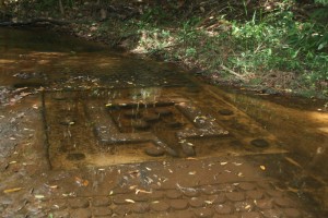 …Thousand Lingas
Symbolic phallic symbols carved into the riverbed to ensure the fertility of his reign – and lots of fish. And this being a good Hindu empire the images of Shiva and Vishnu can be made out beneath the glassy waters. A new bridge spans the Kulen River, its easy to miss this magical link to the past – unless you know its there.
A little further and we arrive at a causeway leading up a hill to the Reclining Buddha. A skyscraper size boulder fashioned into an enormous Buddha. A Khmer pilgrimage site where merit is obtained by stuffing 100 riel notes into every stone orifice.
 The reclining Buddha at Preah Ang Thom
The Ministry of Environment Station is the start for our adventures accompanied by a wired together moto that mechanically shouldn’t work anymore. Mr Pum or whichever ranger is with us for the day has precariously strapped our cool box to his seat and we set off in search of adventure.
The Silver Langur forest butts up to the village. This is where these rare monkeys thought to be gone were rediscovered in 2013. The biggest trees on the mountain still penetrate the canopy, sometimes supporting chicken wing beehives hanging from the top most branches.
Squirrels bark and occasionally when the Kulen fruit are falling from the trees we spot a Silver Langur. Always spiders, great black and yellow shelobs spin their webs across our paths waiting to catch a tourist.
I feel for the precarious existence of the little red males clinging to the furthermost silken threads of the web.
Silver Langur on Mushroom Rock and Golden Orb Spider
We have trails that climb up to Chomran’s hole, nothing personal just an unusual rock formation containing a Buddhist shrine that Chomran climbs into. And descend through a bat-cave to the Kulen River, where we have lunch.
Chomran & his hole and the Bat-cave with a tomb bat
Today we’re slip-sliding through sand on route for Porpel Village and on to Phum Kla Kmum Village for our first temple. It’s a head over handle bar rutted oxcart trail that sort of dwindles to where we walk.
 Soma-sutra at Prasat Krahom & Lors and his linga
So we leave our bikes and clamber over rocks to a platform above the forest and Prasat Krahom (lit. red temple). There’s a decorated spout or soma-sutra on the outside while inside the temple water falling onto the linga is caught in a yoni (the female part) and fed through the brick walls via the soma-sutra to be collected as holy water fit for a fertility or two.
Today we’re trying out a new trail across the cashew nut plantations to Sangke Leak Village.
Mountain biking on Kulen involves thinking about where your going to cycle and what gear you should be in before you need to change but don’t think too hard or you’ll end in a rut and on your ass. Then there’s the sand, ‘look to the horizon, pedal hard and head straight’. Or shout out expletives, “—-ing sand!” As our guests have been known to do.
 Enjoying the scenery after a disagreement with the track
Kulen is carved into mounds – that you need to cycle up and down and a myriad of small streams that you need to cross. The gradient and terrain are the perfect habitat for a mountain bike.
Cambodia was once a big forest and it wasn’t long ago. The majority of forest has gone but the traditional chamkar or slash and burn agriculture remains. A few villagers across thousands of hectares clearing and burning a couple of hectares for small paddy fields was sustainable. Wholesale logging for cashew nut plantations forcing those villages to cut down what’s left is not but lets not spoil a good story.
 Ganesha @ Perng Komnou
There are not many routes out of or for that matter onto Kulen. Scrambling through the burnt logs and small banana plantations down the steep slopes above Svai Leu Town at the Eastern end of the plateau was one not very good option that has now unfortunately got easier. A logging magnate is dynamiting a road up the mountain for an unknown reason. There’s not enough forest left for the obvious. Nearby are the petroglyphs of Perng Komnou (lit. rock shelter). 9th century engravings of Hindu deities like the Ganesha above chiseled into car sized boulders littered around the base of the hill. The excitement of stumbling across these archeological phenomena is one of the reasons I stay in Cambodia.
Today we turned right and avoided the ominous portent of what the road might bring. Phum Ta Pin, Pum Thma Chruon and Anlong Thom, sandy rutted roads between cashew clearings and through small patches of forest. Not great distances, not great roads and ever changing landscapes equal exciting riding.
Smoky mountain villages with towering coconut palms framing stilted wooden houses, chocolate and tan coated pigs plowing their snouts through the mud and litter. And chickens running for their lives as we ride into the village hungry!
 Anlong Thom in the center of Kulen
Anlong Thom feels like the spiritual center of Kulen surrounded by remnants of its lost kingdom, temples that lie not far from the village.
Sweaty, disheveled but bright with the excitement of the ride we moor our bikes in the shade of coconut palms beside the local blacksmith. The cool box is unstrapped from the remains of the moto. Cold beer is served.
We wait while the lady catches one of those unfortunate chickens or a fish from the stream that runs at the bottom of the village and lunch is served.
 The local blacksmith
The big wooden houses tell of a time when the forest canopy was raised by massive trees providing abundant timber. Lifting your room above the ground stops the rats that eat the insects and the snakes that eat them. Motorbikes, cows and timber are secure in the space underneath. Fires were lit to provide a rudimentary if risky heating system when the world was a little cooler.
We head out through the cashew that surrounds the village to the islands of forest (protected by Apsara the temple authority) hiding the ruins we’re searching for. Ok we’ve done it before but today we’re connecting a loop across the mountain. The first stop is the single brick tower of Prasat Thma Dap (below).
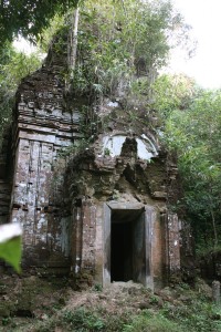
We cross the dam of what the 2013 Lidar survey revealed to be an Angkorian reservoir. Lidar is a laser strapped to a helicopter that records the topography of the terrain. Data fed through a supporting app strips away the vegetation to show the underlying structures of what was a conurbation 1200 years ago. No new Angkor Wat as the press stated at the time but just as astonishing.
Next are the three brick towers of Prasat Domrey Krab, lit. Temple of the kneeling elephant (left), and a short walk away Perng O Eisei (below).
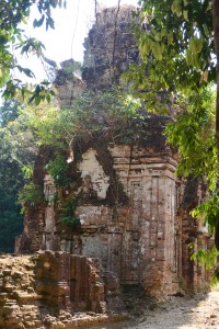
A mysterious and shady hollow, once the home of a hermit, a small spring forms a clear pool with a rock fashioned into a turtle. A stone doorway carved into a boulder is flanked on either side by an Apsara or celestial being.
There’s the sense that the king might not be far away.
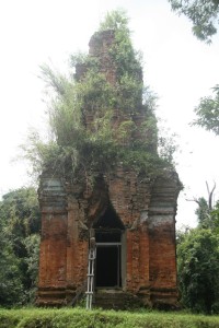
The 10m high brick tower of Prasat O Pong (above) and the pyramid temple of Rorng Chen are not far away. The latter sits on top of a small hill or is a small hill. We could make out the blocks of laterite that form its base but not much else. This was where JII hung out i.e. his palace.
The temples are not far apart but it’s easy to get lost hence the accompanying decrepit moto though of course its main function is to bring cold beer.
Perng Tbal is a first. Tbal means pestle and Perng carving. We didn’t see any carved pestles but a lot gets lost in translation.
A gully between great slabs of stone, not sinister but not explained, a space in a time of its own.
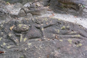 Reclining Vishnu @ Perng Tbal
Another turn in the forest will take you to the kitch Wat Preah Kral. A working pagoda where the wealthy buy their way to heaven via silver and gold stupas perched across the bare rock face. I reclined in Buddha’s chair to view Phnom Bok and on a clear day the Tonle Sap Lake. I sat on his carpet and looked at these strange rock formations. Today we carried on to The Srah Domrey, the most wonderful element of Kulen.
I can remember the hairs on the back of my neck electrified as I first caught sight of this two-thirds life size statue. In those ancient days eleven years ago when I first came to Cambodia there were few visitors to this exceptional place, relative to the swarming hoards that descend on Angkor, there’s not many that make it here now.
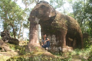
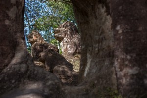 The Sra Domrey above and 3 stone lions seen through its legs.
The story finishes 10 kilometers away at Preah Ang Thom where it started. The mixed evergreen forest around the magical elephant gives way to dry dipteropcarp trees growing out of the rock. The cycle past the village of Phum Thmei and over the bridge across the delightful Kulen mountain stream, where we once swam in its cool pools. Then we’re back in Preah Ang Thom and the hiss of a cold can of beer as I pull the tab. A fitting end to another Kulen adventure.
by Nick | Dec 24, 2017 | Bike, Blog
The Race to the Middle of Nowhere – The Scramble for Kulen
About a thousand years too late but then it wasn’t for the first time, the Angkorians had been here before. And anyway the British, French, Germans and Italians took it in turns to claim large chunks of Africa. I reckoned all we needed to do was plant an Indochine Exploration flag on the top of Phnom Srok, Mr Leang said was the tallest hill on Kulen, to guarantee safe rights of passage across Kulen for our Grasshopper guests the following week.
Lors filled Kuong’s van with enough equipment to rival our pioneering colonial peers, a week perhaps? No just one night but that wasn’t the half of what he’d take for the customers. We were going to swing ourselves to sleep in hammocks under the stars but I wasn’t leaving it to chance and had my camping kit (Vallium, whisky and ear plugs) within easy reach.
The escarpment up Kulen marks a departure from the dusty plains and chaos of Siem Reap. The forest canopy contains a calm that penetrates even Kuong’s van. The MoE Station at Preah Ang Thom by association the furthest reach of our adventurous ancestors into the unknown. Pushing it but that’s where we start our trips from so we emptied the van onto Mr Chou’s Oxcart, while Phum rode round the station getting used to the mountain bike we’d brought him.
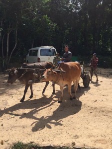 Setting off by oxcart
Lors fresh from his muscle contest in Phnom Penh rippling in lycra, conducted our expedition as we embarked on our mission to cross the empty quarter by way of Porpel Village to Kbal Spean. North of Porpel the path serves the chamkar hacked and burnt out of the original forest.
 Lunch spot
The forest over years painstakingly accumulates a fertility that the cashew nut plantations gorge on then slowly wither to a scraggy halt.
We halted where the path went back under the trees and waited for Chou and his cows. Lors had bought a chicken for them. I’d got a squashed breakfast bagel from Little Red Fox and then on in the adventure started. The chamkar and reason for using the path stopped including logging? Phum said so, incredible! He seemed to be right. It appeared that nobody had been this way for years. There was a path but it was well disguised such that when it changed direction I didn’t and came to an impromptu halt in the bushes.
Chest high grass gave way to forest as we reached the valley and the canopy closed in. Two years ago the saddest logging was taking out the remaining big trees. Now the vegetation was striking back, linking limbs to lock in the road and block the oxcarts that bore the bloodied corpses of the felled trees.
We emerged out of the jungle into a flower studded grassy veld bisected by the Kulen River. Our campsite was given away by rusty pilchard tins now hidden in the tall grass, evidence of Alistair’s search for Silver Langurs.
 Relaxing on the trail and arriving at the campsite
It seemed impossible that Phum and Chou would get the oxcart down the escarpment with no apparent path and then through the jungle so we headed back, fully expecting to abort our mission and spend the night in Anlong Thom. We found them not far along the trail hacking at a fallen tree while the cows contentedly munched the leaves blocking their path.
Our mission to cross Kulen was back within our grasp. Chou had a kettle on the boil while Lors and Phum set up the campsite and I drank tea.
‘Nick get out of the way,’ warned Lors. Phum was flapping his hammock and stamping on the ground to get rid of black ants. ‘I cant get out of the way! Aaargh’ the little bastards stung, but they weren’t immune to deet.

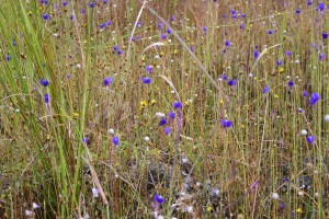 Lors and other flowers of the veld
Only a trickle of water made it down the stream despite the recent rain but the bathing pool remained. I reduced its surface tension by soaping up in the slightly cool water then went back to the campsite to drink beer and watch Lors shirtless cook dinner.
One week on from coming second in The Angkor Body-building Championships, he looked like he could glide like a flying squirrel on his enormous deltoid muscles. Wielding a large bladed kitchen knife he alternated between slicing onions and swatting mosquitoes on Phum for some reason remaining immune to their bites.
We were missing Dean but in his stead he’d sent a family sized pack of chicken casserole supposedly just for Lors and I, actually enough for all of us and their breakfast the next morning. Beer then whisky as Lors and I contentedly chatted about nothing in particular. Mr Chou was wrapped in his hammock betrayed only by his gleaming white smile, 22 and with a baby on the way.
 Lors and Pum preparing supper
A full moon appeared through the canopy and reflected on the bark of the trees that seemed to grow taller in the dark.
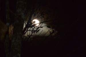
I lay in my hammock looking up through the branches at the stars. A simple camp in the forest worth a million times more than whatever the 5* Sachaya on Bintan Island had cost the week before.
The lingering chill from the night lifted as the sun lit up the leaves around us. Mr Chou and the ox-cart returned to rendezvous with Kuong, while we struck through the wilderness to find a route via the North Escarpment to Kbal Spean, not quite ready for how wild it turned out to be.
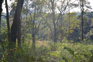 Our campsite at breakfast
Elephant vomit or pig-shit grass life a soft fur covered our way but unlike soft fur it sticks its scratchy seeds to your socks and in your shoes. Enchanted glades of open dipteropcarp deciduous trees gave way to dark caverns shaded by green and lit with white flowers on the forest floor.
The rocks and ruts were throwing me at every opportunity sapping confidence such that I pushed the bike as much as rode it.
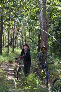 Phum on the trail
We met Leang the policeman with Chomran from Porpel village and 2 rangers with guns though it seemed unlikely that they worked. A few months ago they’d arrested 2 loggers who were in jail presumably trying to find enough money to get out and fined 5 others $1250 each. They were confiscating every chainsaw they found and fining the owners, which explained why the road was disappearing as it had been the loggers that were using it. 3 months ago they’d seen the scratch marks of a bear at Kbal Spean though they reckoned they were still there in the Porpel Community Forest. An old bear had been hunted and killed for its bile. The hunter got $1000 and the middleman $6000 all for some fat, ugly bong thom and his libido.
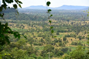 The North Facing Kulen Escarpment
It had been logging central 2 years ago, oxen and carts congregated above the escarpment with crude cut planks from freshly felled timber below, hidden so they couldn’t be spotted from the Wildlife Alliance helicopter that was surveying the mountain. Piled and ready to be collected and taken out via the Forestry Administration HQ who extracted its toll and waited for the next batch to tax. Today there were no signs of logging.
Dr Livingstone I presume? Said Stanley, rather more usefully ‘would you like a beer?’ greeted us as we arrived at Kbal Spean. It had only taken 5 hours but as Dave Taylor had said while lying flat on the grass, ‘this is challenging,’ and technically not a mountain bike ride.
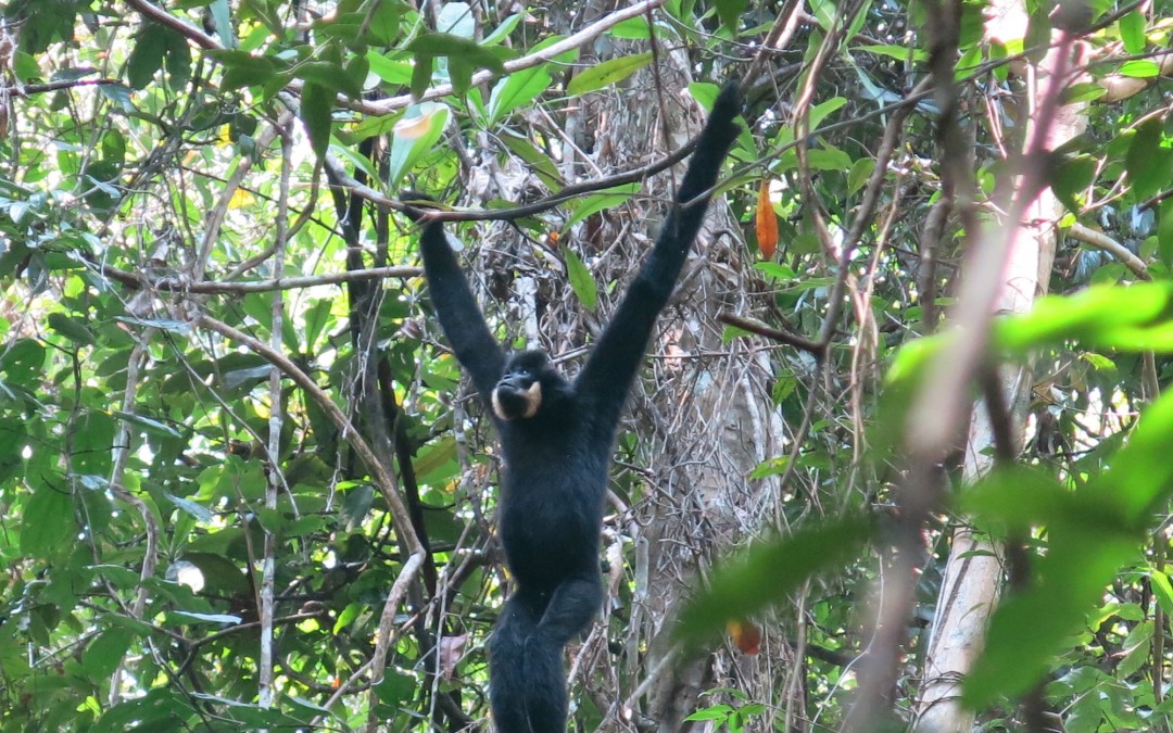
by Nick | Dec 10, 2017 | Blog, Conservation, Hike
An Audience with a Northern Buff Cheeked Crested Gibbon
Etiquette is important in the ape world, or are they monkeys? It all depends on how long the arms are – long, so apes like us, which makes us relatives and our meeting a family call.
We invited the Northern …. Lets say NBCCG’s to visit us in Siem Reap and in days gone by when the North of Cambodia was covered in forest, they would have obliged and swung their way across the country, the slight issue of the Mekong River aside. The patches of trees left are barely enough to sustain a soaring stork so we were on our way via said Mekong to The Terres Rouge Lodge in Banlung.
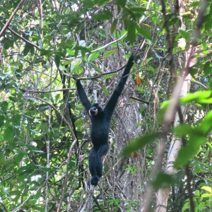 Male Northern Buff Cheeked Crested Gibbon (NBCCG)
We being Jady & I accompanied by Naven from Conservation International and driven by Dy. He’s nearly one of the family now as he’s courting a Chheang, Sreymom, who excepting me pretty much run ICE. It’s a straight forward seven hour journey heading East towards Vietnam on new roads. The orgy of logging is desperate but that’s Cambodia for you.
We opened the car doors to delicious cool and colonial charm of The Terres Rouge Lodge beside Banlung Lake.
Jammy from Red Parrot tours was waiting at his restaurant The Green Carrot. It might have been the other way round. A true entrepreneur he was advertising the unique selling point of his company, which was apparently a free toilet. He’d made a laminate sheet with an explicit cartoon of a man doing his business under a double decker bus.
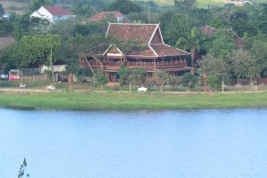 The Terres Rouge Lodge in the old Governors building
There was an adventure to be planned over the red wine and fish oops beer and chicken, a boat up the Sesan River and a trek to a waterfall, an indigenous cemetery then a motorbike ride to the edge of our cousins territory.
The morning light over the lake was a delight as we drank our Khmer coffee and waited for Naven. A smooth red earth road headed North as it descended into the Sesan floodplain and Kchang village where Sresh our boatman and guide for the day’s adventure was waiting for us.
We brushed aside some confusion as to what we were doing, with what and who and boarded Sresh’s narrow wooden long tail. A step up from the usual Sesan river craft as we sat on a dry mat not in the customary half inch of sludge.
Blurred blue hills fringed the horizon as we sped upstream past clumps of stilted houses nestling under shade trees. Ferry’s traversed the river while the inevitable sound of chainsaws reverberated across the water.
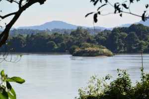 The Sesan River
Our boatman was emerging as Sresh our guide. Clad in not much more than rags hanging off his skinny frame, we found that he’d taught himself rudimentary English when he answered our questions in a gentle toned timbre.
Note; The day’s adventure was an adjunct to our appointment with the cousins as they were busy entertaining Lucky Carrot guests today.
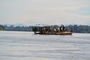 Ferry across The Sesan
Sresh strode ahead in Wellington boots and ripped tracksuit bottoms. Jady and Naven reminisced on the biodiversity workshops they’d attended, while I hobbled behind on a dodgy hip. A cashew nut grove, a cow field then into the open dry deciduous forest with a picture post card view of a village spied through the trees. Bright green paddy fields surrounded thatched roof huts.
We wound our way up a rocky path and spotted a lump of dried turd. ‘Hmm?’ Said Jady, and ‘take a photo,’ ‘a new species?’ Perhaps a serow we mused. ‘Another photo,’ Jady pointed to an orchid implanted on a tree trunk. Our route descended into a riparian forest of bamboo. Sresh hacked at a stem and fashioned a cup, which he gave to me. I was a little crestfallen when the others got one too.
 Sresh (below) and an orchid (above)
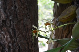
A beautiful walk beside a stream to where a waterfall fell out of the forest a level above. Cascades of spume enshrined the rock face and fell into an oval pool. We needed no invitation to plunge into the cool clear water. Draping ourselves over the warm black rocks, contentedly munching ham and baguettes while staring at the hypnotic diamond droplets of exploding water.
Back on board Sresh’s long tail our next stop was a gloomy tribal graveyard shaded by tall trees. Huts adorned with brightly painted 2D ships for the journey ahead or the one past. A man with shades and woman with boobs stood guard to keep an eye on an electric fan in case it got hot. Empty beer cans, you can get 50 Riel for the aluminum and mummified rice, which lasts forever.
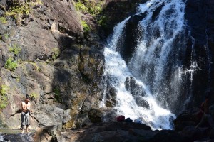 Koh Peap Waterfall (above) and village cemetery (right)
The English speaking guides (that didn’t) including the handsome Noi were waiting for us at Veunsai to take us to the CI Station. Jady and I would have probably preferred to go back to The Banlung Lodge but we had an appointment to keep so we duly sat aside the beaten up old bikes, dangled our legs as there were no foot rests and squeezed the driver in my case Noi, with my thighs.
An earthmover had cleared the way and bulldozed the trees a year before which meant the road was deeply rutted and bereft of shade but interesting enough. At ITub Village we turned off to cross a marsh leaving us wading through the wetland to rejoin our bikes before the forest. Chamkar or slash and burn agriculture aside the trees became taller and our route easier under the canopy.
A crude wooden bridge crossed the river beside the station and on the other side a fenced compound of tall timbered buildings where we’d stay the night. A pleasant evening with Jady and cold beer, chatting with Noi the handsome (did I say that before) English speaking guide who tried but didn’t. There was a fan in my room until 9 when the generator was turned off but rain had cooled the evening and it felt good to be in the middle of the forest sipping whisky and listening to In The Psychiatrists Chair in the dark.
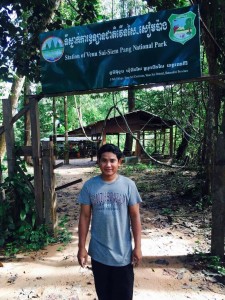 Conservation International Station at Veun Sai Siem Pang
6 hours later I was fumbling in the dark to find my phone and a light. I stumbled to the deserted kitchen shack and managed to light the gas for a cup of tea. Growled at Naven coz no one was awake then hobbled off through the mud in the pitch black following a ranger who seemed unaware I was there.
Note that although priority No 1 was to meet the family we’d also hope that the process of getting there would be up to the Albino standard, it wasn’t.
Grumpy by default at 5am in the morning I blundered on behind. So what if I got lost, well that would be their fault! Jady hung back to make sure I didn’t and as the predawn glow penetrated the trees my mood lifted with the mist.
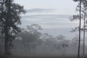 Dawn at the edge of the forest
We’d agreed that the NBCCG’s would call leading us to their front door but damp from the night’s rain they were taking longer over their toilet than usual. We set off into the forest anyway in the hope of meeting at a favorite breakfast spot. Pockets of idyll remain and this was one of them. Like a priest in a cathedral our Gibbon conducted the service from his pulpit 10 meters above.
Sarah, a phd researcher and Naven referred to him as JII, which meant he’d built Angkor Wat. We could just make his buff cheeks (this is an objective statement). A little further and the female was spotted followed by 3 juveniles. Our breakfast was waiting on a crude table beside the trees though we’d have killed for a cup of coffee.
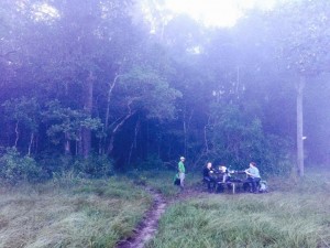 Breakfast at the edge of the forest
I said goodbye to Noi regretting he wasn’t my motorbike driver for the journey our through the swamps to Veunsai. The Sesan Ferry where the ferryman knocked a motorbike into the river and Dy on the other side for the drive to Banlung. One night and a big adventure felt like a lifetime as I hobbled around the spread out streets of the town.